Tag

#SpaceExploration

Browsing

Asteroids Hitting the Earth: Searching for 10 Million Near-Earth Threats Every Year

Key Takeaway

The Sutter Ultra project by Trans Astronautics Corp (TransAstra) aims to revolutionize our understanding of near-Earth asteroids (NEAs). With the potential to discover 10 million asteroids annually, this ambitious initiative seeks to reduce the threat of NEAs while also providing valuable resources for future space exploration.

Summary

  • Project Overview: Sutter Ultra aims to detect 10 million near-Earth asteroids annually.
  • Current NEA Data: Approximately 34,000 NEAs have been identified to date.
  • Estimated NEAs: Scientists estimate up to 1 billion NEAs larger than a modern car exist near Earth.
  • Project Funding: Funded by NASA’s Institute for Advanced Concepts with a Phase II grant.
  • Technological Challenges: Detection issues due to the brightness and speed of asteroids.
  • Sutter Ultra’s Innovation: Utilizes three spacecraft with over 100 telescopes each in a heliocentric pseudo geocentric distant retrograde orbit.
  • Algorithm Advantage: Superior tracking algorithm designed by TransAstra.
  • Impact Potential: Project could significantly enhance asteroid tracking and space debris management.
  • Cost and Phases: Estimated cost of $400 million, with a phased approach for development.
  • Future Implications: Potential to revolutionize space economy and safety.

Introduction

Near-Earth asteroids (NEAs) have fascinated and frightened humanity for centuries. These celestial bodies, which orbit close to Earth, are not only potential threats but also hold vast opportunities for space exploration and resource utilization. With the advent of advanced technology, scientists are now able to track and study these asteroids more effectively than ever before. One of the most promising initiatives in this field is the Sutter Ultra project by Trans Astronautics Corp (TransAstra).

The Current State of NEA Discovery

To date, scientists have identified approximately 34,000 NEAs. These asteroids, which vary in size and composition, represent only a small fraction of the total number estimated to be in near-Earth space. Some estimates suggest that up to 1 billion asteroids larger than a modern car exist in the vicinity of Earth. This discrepancy highlights the vast unknown territory that remains to be explored and understood.

The Challenges of NEA Detection

Detecting NEAs presents significant challenges. The primary issues are brightness and speed. Most ground-based observatories have long exposure times, which are effective for capturing bright and relatively stationary objects. However, NEAs move quickly and are typically faint, making them difficult to detect with standard long exposure techniques. As these asteroids move multiple pixels during each exposure, they often appear too dim to be captured in traditional surveys.

The Sutter Ultra Project

TransAstra’s Sutter Ultra project aims to overcome these challenges through innovative technology and advanced algorithms. Funded by NASA’s Institute for Advanced Concepts with a Phase II grant in 2021, Sutter Ultra is named after the Sutter Mill discovery that triggered the California gold rush of 1849. However, the technology involved in Sutter Ultra is far more sophisticated than the prospector’s pan used in the 19th century.

Technological Innovation

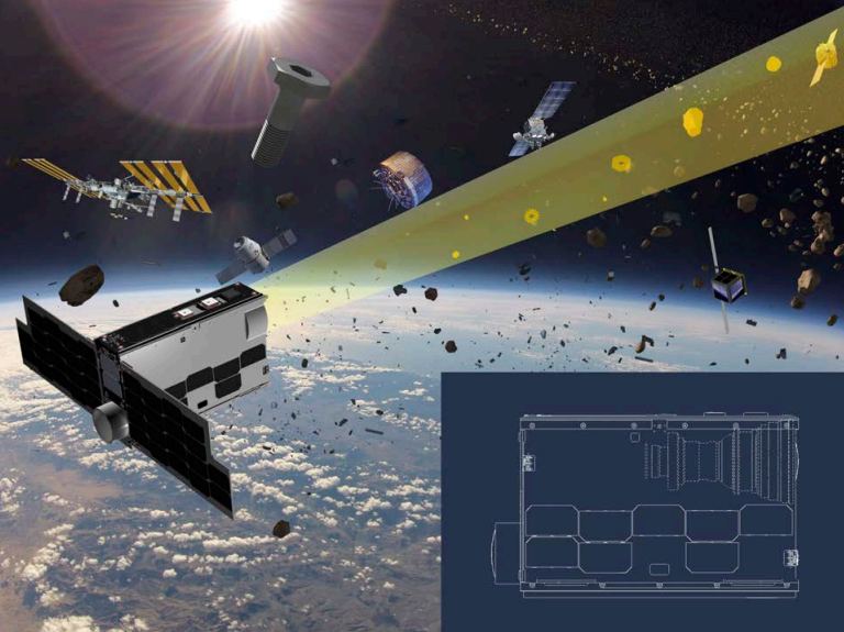
The Sutter Ultra system comprises three separate spacecraft, each equipped with over one hundred 30 cm telescopes. These spacecraft will operate in a heliocentric pseudo geocentric distant retrograde orbit (PRO). This unique orbit allows the spacecraft to maintain a consistent focus on Earth and triangulate their readings in a way that is not possible with ground-based observatories.

Advanced Algorithms

Once the data is captured, TransAstra’s advanced algorithm comes into play. This algorithm is designed to track individual asteroids across their paths within the captured images. According to TransAstra’s calculations, this method is significantly superior to existing asteroid tracking techniques. A presentation by TransAstra President Joel Sercel highlighted that the Sutter Ultra project could potentially find 300 times the total number of NEAs humanity has ever discovered in its first year of operation. This translates to an astonishing 10 million asteroid detections annually, or approximately 19 new asteroids every minute.

Potential Impact and Applications

The implications of the Sutter Ultra project extend far beyond mere asteroid detection. NEAs are some of the most dangerous objects in the solar system due to their potential for catastrophic impacts. By significantly improving our ability to track these objects, Sutter Ultra could play a crucial role in planetary defense.

Space Debris Tracking

In addition to tracking NEAs, Sutter Ultra could also be instrumental in managing space debris. The increasing amount of junk in Earth’s orbit poses a growing threat to satellites, spacecraft, and space missions. Several companies are developing technologies to deorbit space junk or neutralize it using lasers. However, effective tracking is essential for these efforts. If the Sutter Ultra project lives up to its potential, it could become the most effective system for tracking space debris, thereby enhancing the safety and sustainability of space activities.
Asteroids Hitting the Earth: Searching for 10 Million Near-Earth Threats Every Year

Project Phases and Funding

TransAstra is approaching the ambitious Sutter Ultra project with a three-step strategy to make the $400 million price tag more palatable to funding agencies. The first phase involves establishing a ground system as part of its NIAC Phase II project. The next step is the Sutter Alpha mission, which will utilize a CubeSat platform as a proof of concept. Following this, the Sutter Survey mission will deploy three spacecraft in low Earth orbit (LEO), each equipped with four telescopes.

Phased Approach

  1. Ground System Development: Initial phase involving the creation of a ground-based observational system.
  2. Sutter Alpha Mission: Utilizing a CubeSat platform to test the concept in space.
  3. Sutter Survey Mission: Deploying three spacecraft in LEO with four telescopes each.

This phased approach allows for incremental advancements and testing, ensuring that each step builds upon the success of the previous one. However, the timing for the full Sutter Ultra mission remains uncertain, and the ultimate goal of the original grant is still in jeopardy.

Future Prospects and Implications

Despite the uncertainties, TransAstra is at the forefront of developing sophisticated systems for surveying near-Earth asteroids. If successful, the Sutter Ultra project could uncover more NEAs than humanity has ever discovered, significantly advancing our understanding of these celestial bodies. The potential to discover 10 million asteroids annually would mark a monumental leap in space exploration and safety.

Economic Potential

The economic implications of such a discovery are profound. NEAs contain valuable resources, including metals and water, which could be harvested for use in space exploration and future space economies. The ability to identify and track these resources could transform them into valuable real estate for mining and resource extraction in space.

Planetary Defense

From a planetary defense perspective, improved NEA tracking would enhance our ability to predict and mitigate potential asteroid impacts. By identifying potentially hazardous asteroids early, we could develop strategies to divert them or minimize their impact on Earth. This capability is crucial for safeguarding our planet from future asteroid threats.

Tables

Table 1: Key Features of Sutter Ultra Project

Feature Description
Number of Spacecraft 3
Number of Telescopes Over 100 per spacecraft
Orbit Type Heliocentric pseudo geocentric distant retrograde orbit (PRO)
Detection Capability 10 million asteroids annually
Estimated Project Cost $400 million
Phased Approach Ground system, CubeSat proof of concept, LEO deployment

Table 2: Phases of Sutter Ultra Project

Phase Description Timeline
Ground System Development Establishment of a ground-based observational system Ongoing
Sutter Alpha Mission CubeSat platform proof of concept Near Future
Sutter Survey Mission Deployment of three spacecraft in LEO with four telescopes each To Be Determined

Conclusion

The Sutter Ultra project by TransAstra holds the potential to revolutionize our understanding of near-Earth asteroids and significantly enhance our ability to track space debris. With the ambitious goal of discovering 10 million asteroids annually, Sutter Ultra could transform both space exploration and planetary defense. Despite the challenges and uncertainties, the phased approach and innovative technology behind the project position it as a leading initiative in the quest to understand and utilize near-Earth asteroids.

Hashtags

#Asteroids, #NEA, #SutterUltra, #TransAstra, #SpaceExploration, #PlanetaryDefense, #SpaceDebris, #SpaceMining, #NASA, #SpaceEconomy

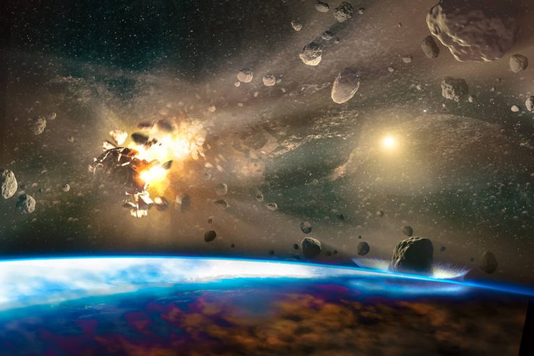
Water Frost on Mars Discovered: ‘We Thought It Was Impossible’ Near Red Planet’s Equator

Key Takeaway:

Water frost has been discovered for the first time near Mars’s equator, challenging previous beliefs that frost couldn’t exist in this region due to its warm temperatures and thin atmosphere. This finding, made by ESA’s ExoMars Trace Gas Orbiter and Mars Express, suggests exceptional processes at play and has significant implications for understanding water distribution and climate on Mars.

Summary:

  • Discovery: Water frost found near Mars’s equator, a region previously believed too warm for frost.
  • Instruments: ESA’s ExoMars Trace Gas Orbiter (TGO) and Mars Express.
  • Location: Tharsis region, home to the largest volcanic mountains, including Olympus Mons.
  • Significance:
  • Details:
    • Frost is thin and ephemeral, forming only for a few hours at sunrise.
    • Covers a vast area despite its thinness, containing water equivalent to 60 Olympic swimming pools.
  • Scientific Implications:
    • Shows water exchanges between Mars’s atmosphere and surface.
    • Reveals Earth-like meteorological processes on Mars.
  • Research Team: Led by Adomas Valantinas, a PhD student at the University of Bern, Switzerland.
  • Publication: Study published in Nature Geoscience.
Water Frost on Mars: Challenging the Impossible

Water frost has been discovered for the first time near Mars’s equator, a region where scientists previously believed frost formation was impossible. This unexpected finding could reshape our understanding of Martian climate and water distribution, with significant implications for future Mars exploration.

The Discovery

Adomas Valantinas, a PhD student at the University of Bern, Switzerland, made this groundbreaking discovery using data from two European Space Agency (ESA) missions: the ExoMars Trace Gas Orbiter (TGO) and the Mars Express. Valantinas, now a postdoctoral researcher at Brown University, expressed his astonishment:

“We thought it was impossible for frost to form around Mars’ equator, as the mix of sunshine and thin atmosphere keeps temperatures relatively high at both surface and mountaintop – unlike what we see on Earth, where you might expect to see frosty peaks. Its existence here is exciting and hints that there are exceptional processes at play that are allowing frost to form.”

The TGO, which arrived at Mars in 2016, and Mars Express, which has been orbiting the planet since 2003, played crucial roles in this discovery. Both spacecraft have orbits that allow them to observe the Martian surface at various times of the day, including early morning when the frost forms. This capability was vital, as frost on Mars’s equator appears briefly around sunrise before evaporating under the sun’s rays.

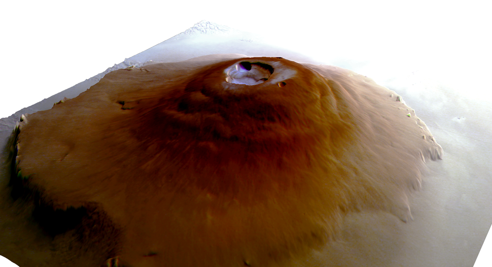
A view of Olympus Mons from the side shows a wide patch of thin ice. (Image credit: ESA/DLR/FU Berlin)

Location: Tharsis Region

The frost was detected in the Tharsis region, the largest volcanic area on Mars. This region includes 12 large volcanoes, such as:

These volcanoes have deep hollows at their summits called “calderas,” created by magma chambers during eruptions. The team believes that unique microclimates within these calderas, driven by air circulation patterns, allow frost to form.

Microclimates and Frost Formation

According to Nicolas Thomas, Principal Investigator of TGO’s Colour and Stereo Surface Imaging System (CaSSIS):

“Winds travel up the slopes of the mountains, bringing relatively moist air from near the surface up to higher altitudes, where it condenses and settles as frost. We actually see this happening on Earth and other parts of Mars, with the same phenomenon causing the seasonal Martian Arsia Mons Elongated Cloud.”

The frost patches are incredibly thin, with a thickness equivalent to that of a human hair (about one-hundredth of a millimeter). Despite their thinness, they cover extensive areas of the volcanoes, with their water content potentially filling 60 Olympic swimming pools, or about 29.4 million gallons (111 million liters) of water.

Scientific Implications

This discovery has several important scientific implications:

  1. Water Exchange: It highlights the dynamic exchange of water between Mars’s atmosphere and surface. This exchange is critical for understanding the planet’s climate and water cycle.
  2. Microclimate Formation: The presence of frost suggests unique microclimates on Mars, driven by specific air circulation patterns.
  3. Comparative Planetology: The finding provides insights into Earth-like meteorological processes on Mars, enhancing our understanding of both planets’ climates.

Research Challenges and Future Exploration

Detecting frost at Mars’s equator was challenging due to several factors. Most Mars orbiters are synchronized to observe the planet in the afternoon, making it difficult to catch the frost, which forms only in the early morning. Additionally, frost deposition is linked to colder Martian seasons, further narrowing the window for observation.

Adomas Valantinas explained:

“Firstly, we need an orbit that lets us observe a location in the early morning. While ESA’s two Mars orbiters – Mars Express and TGO – have such orbits and can observe at all times of day, many from other agencies are instead synchronized to the sun and can only observe in the afternoon. Secondly, frost deposition is linked to colder Martian seasons, making the window for spotting it even narrower.”

Future Research Directions

The discovery of water frost near Mars’s equator opens new avenues for research:

  • Detailed Climate Modeling: Improved models of Mars’s climate are needed to understand the conditions that allow frost to form in equatorial regions.
  • Microclimate Studies: Further investigation into the unique microclimates of the Tharsis region could reveal more about atmospheric and surface interactions on Mars.
  • Human Exploration: Understanding water distribution on Mars is crucial for future human missions, as water is essential for life support and fuel production.

“Finding water on the surface of Mars is always exciting, both for scientific interest and for its implications for human and robotic exploration. Even so, this discovery is particularly fascinating.”

Frost on the caldera floor of the Ceraunius Tholus volcano. The frames show (A) a view of Ceraunius Tholus from NASA's Mars Reconnaissance Orbiter's Context Camera. Early morning observations made by CaSSIS are overlaid within the blue-toned rectangle. This rectangle is shown close-up in frame (B). The white rectangle marking an even more zoomed-in image is shown in frame (C). Frost is on the caldera floor, but there is none on the caldera rim. (D) shows a CaSSIS image of the same region acquired at a different time of day, with the frost gone. (Image credit: ESA/DLR/FU Berlin)
Frost on the caldera floor of the Ceraunius Tholus volcano. The frames show (A) a view of Ceraunius Tholus from NASA’s Mars Reconnaissance Orbiter’s Context Camera. Early morning observations made by CaSSIS are overlaid within the blue-toned rectangle. This rectangle is shown close-up in frame (B). The white rectangle marking an even more zoomed-in image is shown in frame (C). Frost is on the caldera floor, but there is none on the caldera rim. (D) shows a CaSSIS image of the same region acquired at a different time of day, with the frost gone. (Image credit: ESA/DLR/FU Berlin)

Comparative Analysis: Earth vs. Mars

Despite the thin atmosphere and low temperatures on Mars, the discovery of frost highlights similarities between Martian and Earth climates. On Earth, frost forms in high-altitude regions where moist air cools and condenses. A similar process appears to be at work on Mars, albeit under different atmospheric conditions.

Conclusion

The discovery of water frost near Mars’s equator is a remarkable achievement that challenges our understanding of the Red Planet’s climate. It stresses the importance of continued exploration and observation, using advanced instruments and innovative approaches. This finding not only enhances our knowledge of Mars but also provides valuable insights into planetary climates and the potential for water on other celestial bodies.

Tables

Table 1: Key Features of Mars’s Tharsis Volcanoes

Volcano Name Height (miles) Height (kilometers) Notable Features
Olympus Mons 18.6 29.9 Tallest peak in the solar system
Ascraeus Mons 9.3 15.0 Large caldera, significant lava flows
Arsia Mons 11.8 19.0 Known for its elongated cloud
Pavonis Mons 8.7 14.0 Central location among Tharsis volcanoes
Ceraunius Tholus 3.1 5.0 Smaller but significant volcanic activity

Table 2: Frost Formation on Mars vs. Earth

Parameter Mars Earth
Atmospheric Pressure 0.6% of Earth’s 101.3 kPa
Temperature Range -195°F to 70°F (-125°C to 20°C) -128°F to 134°F (-89°C to 57°C)
Frost Formation Occurs in early morning on slopes High altitudes, cold regions
Water Content in Frost Extremely thin, covers large area Variable, dependent on humidity

References

  • European Space Agency (ESA): Information about the ExoMars Trace Gas Orbiter and Mars Express missions.
  • Nature Geoscience: Research publication detailing the discovery of water frost near Mars’s equator.
  • NASA: Contextual information on Mars’s atmosphere and climate.

Hashtags

#Mars, #WaterFrost, #SpaceExploration, #TharsisRegion, #OlympusMons, #ESA, #ExoMars, #MarsExpress, #PlanetaryScience, #FutureExploration

Space Photo by NASA Today: June 11, 2024

Key Takeaway

The cosmos is a beautiful sight filled with stars, nebulae, and galaxies. Every part of the sky tells its own story through its colors and patterns. On June 11, 2024, NASA’s featured space photo shows the stunning area around Antares and the Rho Ophiuchi star system. This bright region showcases the beauty and complexity of our universe.

Space Photo by NASA Today: June 11, 2024

Summary

  • Image Overview
  • Characteristics of Nebulae in the Image
    • Reflection Nebulae: Blue due to fine dust illuminated by starlight.
    • Emission Nebulae: Red due to gaseous clouds excited by ultraviolet starlight.
    • Dark Nebulae: Appears dark due to backlit dust clouds blocking starlight.
  • Key Features
    • Antares: A red supergiant star lighting up surrounding clouds.
    • Rho Ophiuchi: Star system at the center of the blue reflection nebula.
    • IC 4605: Reflection nebula below and to the right of the image center.
  • Astronomical Significance
    • Insights into the interaction of light and interstellar matter.
    • Study of stellar formation and the life cycles of stars.
  • Observation Techniques
    • Telescopic imagery for capturing detailed visuals.
    • Spectroscopy for analyzing nebulae composition.
    • Space missions for enhanced clarity and spectrum analysis.
  • Cultural and Historical Context
    • Importance of star naming conventions and historical significance.

Image Overview

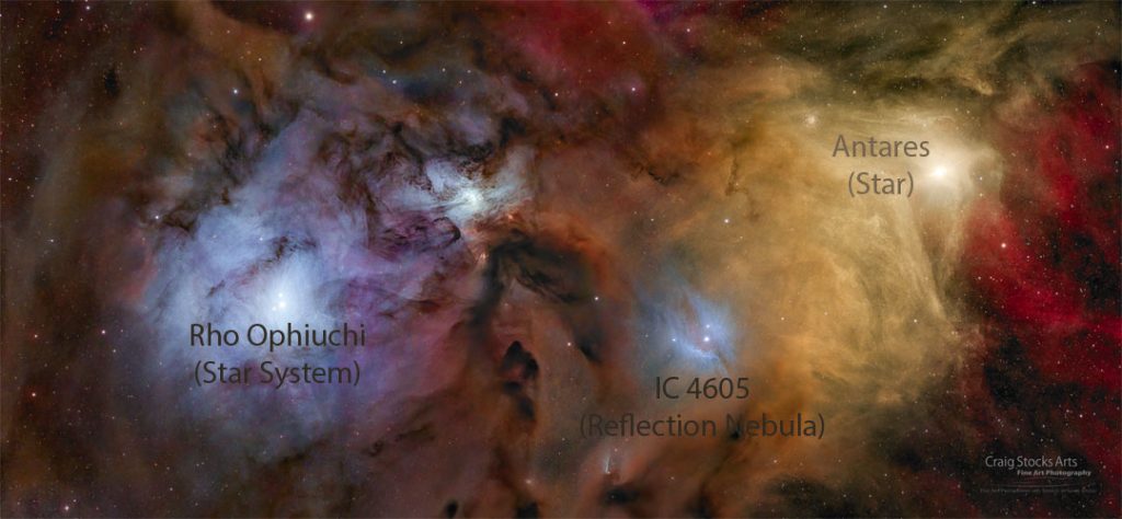
The featured image showcases the colorful nebulae and stars surrounding Antares and the Rho Ophiuchi star system. The yellow star Antares is visible on the left, while blue reflection nebulae encircle a central nebula, with another nebula on the right enveloping the Rho Ophiuchi star system. This vivid scene is a result of various astrophysical processes that produce a spectrum of colors.

Characteristics of Nebulae in the Image

The colors and features of the nebulae in this image are influenced by several factors:

Reflection Nebulae

Reflection nebulae appear blue because they are composed of fine dust particles that scatter the light of nearby stars. This scattering effect is more efficient for shorter (bluer) wavelengths of light, similar to the way Earth’s atmosphere scatters sunlight to create a blue sky. In this image, the blue reflection nebulae are illuminated by the stars in the Rho Ophiuchi star system.

Emission Nebulae

Emission nebulae glow red due to the ionization of gas by high-energy ultraviolet starlight. When the atoms in the gas become excited, they emit light at specific wavelengths, primarily in the red part of the spectrum. This process creates the reddish hues seen in parts of the image, particularly around areas where massive, young stars are present.

Dark Nebulae

Dark nebulae are regions where dense clouds of dust block the light from stars and other objects behind them. These nebulae appear as dark patches against the brighter background of stars and nebulae. The complicated patterns of light and shadow in the image highlight the presence of these dark nebulae.

Table 1: Characteristics of Nebulae in the Image

Type Description Appearance in Image
Reflection Nebulae Fine dust illuminated by starlight Blue regions
Emission Nebulae Gas excited by ultraviolet starlight Red regions
Dark Nebulae Dense dust clouds blocking starlight Dark patches

Key Features

Several key features make this image particularly noteworthy:

Antares

Antares is a red supergiant star, one of the brightest stars in the night sky. It is located on the left side of the image and illuminates the surrounding yellow-red clouds. The star’s immense size and luminosity significantly impact the nebulae around it, making this region a hotspot for astronomical study.

Rho Ophiuchi

The Rho Ophiuchi star system lies at the center of the blue reflection nebula on the left side of the image. This system consists of multiple stars that provide the light necessary for the surrounding nebula to shine. The interplay between these stars and the surrounding dust creates a striking visual effect.

IC 4605

IC 4605 is another reflection nebula located just below and to the right of the image center. This nebula adds to the complexity and beauty of the scene, showcasing the diversity of nebular structures and compositions within a relatively small region of space.

Table 2: Key Features in the Image

Feature Description Position in Image
Antares Red supergiant star Left
Rho Ophiuchi Star system with blue reflection nebula Center-left
IC 4605 Reflection nebula Below and right of center
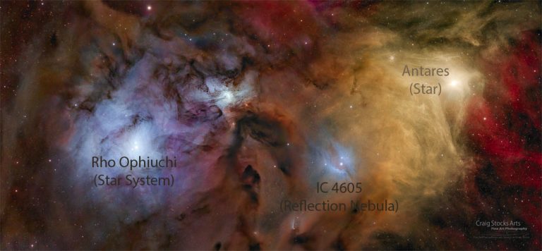
Colorful Stars and Clouds near Rho Ophiuchi Image Credit & Copyright: Craig Stocks Space Photo by NASA Today 2024 June 11
Colorful Stars and Clouds near Rho Ophiuchi
Image Credit & Copyright: Craig Stocks

Astronomical Significance

The region around Antares and Rho Ophiuchi is of great interest to astronomers for several reasons:

Interaction of Light and Matter

The interplay of light and matter in this region provides valuable insights into the processes that govern the behavior of interstellar dust and gas. By studying how light is scattered, absorbed, and emitted by these materials, astronomers can learn more about the physical properties of nebulae.

Star Formation

Nebulae are often sites of active star formation. The presence of young, hot stars in the Rho Ophiuchi region suggests that new stars are being born here. Understanding the conditions that lead to star formation helps astronomers piece together the life cycles of stars and the evolution of galaxies.

Electromagnetic Spectrum

The colorful nebulae in this region emit light across the entire electromagnetic spectrum, from radio waves to gamma rays. Observing these emissions provides a comprehensive picture of the physical processes occurring in nebulae. Different wavelengths of light reveal different aspects of the nebulae, allowing astronomers to study their structure, composition, and dynamics in detail.

Observation Techniques

Telescopic Imagery

Telescopes, both ground-based and space-based, are essential for capturing detailed images of nebulae. The Hubble Space Telescope, for example, has provided stunning views of nebulae by observing them in visible, ultraviolet, and infrared light. These images reveal the intricate details and structures within nebulae.

Spectroscopy

Spectroscopy is a powerful tool for analyzing the light from nebulae. By splitting the light into its component wavelengths, astronomers can determine the composition, temperature, density, and motion of the gas and dust in the nebulae. This information is crucial for understanding the physical conditions and processes within these regions.

Space Missions

Space missions, such as the Hubble Space Telescope and the upcoming James Webb Space Telescope, play a crucial role in advancing our understanding of nebulae. These missions allow astronomers to observe nebulae in wavelengths of light that are not accessible from the ground, providing a more complete picture of these fascinating objects.

Cultural and Historical Context

The stars and nebulae featured in this image have been known to humanity for centuries. Antares, in particular, has a long history of observation and significance. Named after Ares, the Greek god of war, Antares has been a prominent fixture in the night sky and a key navigational star for ancient sailors.

The constellation Ophiuchus, where the Rho Ophiuchi star system is located, represents the serpent-bearer in Greek mythology. This constellation’s connection to ancient myths and stories highlights the enduring human fascination with the stars and the rich cultural heritage associated with celestial objects.

Conclusion

The colorful nebulae and stars near Antares and Rho Ophiuchi offer a stunning and insightful glimpse into the universe. The mixture of reflection, emission, and dark nebulae creates a vivid and dynamic scene that reveals the complex interactions between light and matter in space. By studying regions like this, astronomers gain valuable knowledge about the processes that shape our galaxy and the life cycles of stars.

The image also reminds us of the deep cultural and historical connections we have with the stars, stressing the timeless human quest to understand the cosmos. Whether viewed through the lens of a telescope or the stories of ancient mythology, the stars continue to inspire wonder and curiosity.

Hashtags

#SpacePhoto, #NASA, #Nebulae, #Antares, #RhoOphiuchi, #Astronomy, #Cosmos, #StarFormation, #SpaceExploration, #HubbleSpaceTelescope, #JamesWebbSpaceTelescope, #Astrophotography

Indian Space Research Organisation (ISRO)

Key Takeaway

The Indian Space Research Organisation (ISRO), headquartered in Bengaluru, India, has emerged as a global leader in space research and exploration. Established on August 15, 1969, ISRO has achieved remarkable milestones, including launching extraterrestrial missions, developing advanced launch vehicles, and operating a vast satellite network. Its missions like Chandrayaan and Mangalyaan have significantly contributed to space science, while initiatives like Gaganyaan aim to further India’s capabilities in human spaceflight.

Summary

  • Formative Years: Contributions from early Indian scientists; establishment of the Department of Atomic Energy (DAE) and initial space science experiments.
  • Formation of INCOSPAR: Creation of the Indian National Committee for Space Research in 1962.
  • Evolution into ISRO: Transition from INCOSPAR to ISRO in 1969, establishment of the Space Commission and the Department of Space in 1972.
  • Development of Launch Vehicles: Successful development of SLV, PSLV, and GSLV.
  • Achievements and Milestones: Key missions like Chandrayaan-1, Chandrayaan-2, Chandrayaan-3, and Mangalyaan.
  • Solar Exploration: Launch of Aditya-L1 to study the sun.
  • Organizational Structure and Facilities: Overview of ISRO’s main facilities and their roles.
  • Goals and Objectives: ISRO’s mission statement and key goals.
  • Human Spaceflight Program: Gaganyaan mission and astronaut training facilities.
  • Future Projects: Upcoming missions to the Moon, Mars, and Venus, as well as advances in spacecraft propulsion.
  • International Collaborations: Notable partnerships with other space agencies.

Indian Space Research Organisation (ISRO)

The Indian Space Research Organisation (ISRO), headquartered in Bengaluru, India, has emerged as a key player in global space research and exploration. Formed on August 15, 1969, and succeeding the Indian National Committee for Space Research (INCOSPAR), ISRO has made significant strides in space technology, becoming one of the few space agencies worldwide with full launch capabilities, cryogenic engine deployment, extraterrestrial mission launches, and operation of a vast satellite fleet.

Formative Years

The foundation of modern space research in India can be traced back to the 1920s when scientist S. K. Mitra conducted ionospheric experiments through ground-based radio in Kolkata. Renowned scientists like C.V. Raman and Meghnad Saha contributed significantly to space science principles. After 1945, key developments were made by scientists Vikram Sarabhai, founder of the Physical Research Laboratory in Ahmedabad, and Homi Bhabha, who established the Tata Institute of Fundamental Research in 1945.

Initial space science experiments involved cosmic radiation studies, high-altitude testing, and deep underground experimentation at the Kolar mines. These studies were performed at various research laboratories, universities, and independent locations.

In 1950, the Department of Atomic Energy (DAE) was established with Bhabha as its secretary, providing funding for space research across India. The establishment of observatories and research institutes like the Aryabhatta Research Institute of Observational Sciences (ARIES) and the Rangpur Observatory marked significant advancements in India’s space research endeavors.

Formation of INCOSPAR

In 1962, the Indian National Committee for Space Research (INCOSPAR) was set up by Prime Minister Jawaharlal Nehru on the recommendation of Dr. Vikram Sarabhai. The committee’s activities initially operated under the DAE, with officers from the Indian Ordnance Factories contributing their expertise in propellants and advanced light materials for rocket construction. The Thumba Equatorial Rocket Launching Station (TERLS) was established for launching sounding rockets, initiating India’s upper atmospheric research.

Evolution into ISRO

Under the government of Indira Gandhi, INCOSPAR was replaced by ISRO in 1969. In 1972, a space commission and the Department of Space (DoS) were established to oversee space technology development in India, institutionalizing space research in the country. The first satellite, Aryabhata, was launched by the Soviet Union in 1975, marking India’s entry into space exploration.

Development of Launch Vehicles

Efforts to develop an orbital launch vehicle began after mastering sounding rocket technology. The Satellite Launch Vehicle (SLV) was developed to launch small payloads into low Earth orbit. The SLV’s first successful launch occurred in 1980, making India the seventh country to reach Earth’s orbit.

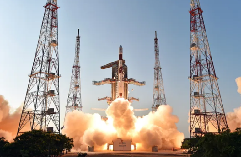
The Polar Satellite Launch Vehicle (PSLV) was introduced in the 1990s, becoming a major success for ISRO. With over 50 successful flights, PSLV enabled India to launch numerous domestic and foreign satellites. The development of the Geosynchronous Satellite Launch Vehicle (GSLV) followed, though initial attempts to procure cryogenic engines from Russia faced US-imposed restrictions. Despite these challenges, India developed its indigenous cryogenic technology, marking significant advancements in its space capabilities.

This is an artist's illustration of India's Chandrayaan-1 lunar spacecraft. It shows the spacecraft orbiting the moon. (Image credit: Dan Roam)
This is an artist’s illustration of India’s Chandrayaan-1 lunar spacecraft. It shows the spacecraft orbiting the moon. (Image credit: Dan Roam)

Achievements and Milestones

ISRO’s achievements have significantly impacted India’s socio-economic development, supporting civilian and military domains in various aspects, including disaster management, telemedicine, navigation, and reconnaissance missions. Notable missions include Chandrayaan-1, India’s first mission to the Moon, and the Mars Orbiter Mission (Mangalyaan), which made India the first country to reach Mars orbit on its first attempt.

Chandrayaan Missions

Chandrayaan-1, launched in 2008, was the first mission to confirm the presence of water on the Moon. The mission included a lunar orbiter and an impactor, conducting extensive lunar surface studies.

Chandrayaan-2, launched in 2019, consisted of an orbiter, a lander (Vikram), and a rover (Pragyan). Although the lander failed to soft-land, the orbiter continues to provide valuable data.

Chandrayaan-3, launched in 2023, achieved a successful soft landing on the Moon’s south pole, making India the first country to achieve this feat.

Mars Orbiter Mission

The Mars Orbiter Mission (Mangalyaan), launched in 2013, made India the first country to enter Mars orbit on its maiden attempt. The mission’s success at a record low cost of $74 million demonstrated ISRO’s efficiency and technological prowess.

Solar Exploration

On September 2, 2023, ISRO launched Aditya-L1, India’s first solar probe, to study the solar corona and coronal mass ejections. This mission aims to enhance our understanding of solar activities and their impact on space weather.

Organizational Structure and Facilities

ISRO is managed by the Department of Space, which oversees various agencies and institutes involved in space research and development. Key facilities include:

  • Vikram Sarabhai Space Centre (VSSC): The primary technical center for SLV, ASLV, and PSLV development.
  • Liquid Propulsion Systems Centre (LPSC): Handles the design and development of liquid propulsion systems.
  • Space Applications Centre (SAC): Focuses on the practical applications of space technology, including remote sensing and satellite communications.
  • Satish Dhawan Space Centre (SDSC): The main launch site for India’s satellites, located at Sriharikota.

Goals and Objectives

ISRO’s mission includes the development and application of space technologies to address real-world problems and contribute to national development. As Vikram Sarabhai, the father of the Indian space program, stated:

“To us, there is no ambiguity of purpose. We do not have the fantasy of competing with economically advanced nations in the exploration of the Moon or the planets or manned space-flight. But we are convinced that if we are to play a meaningful role nationally and in the community of nations, we must be second to none in the application of advanced technologies to the real problems of man and society.”

Key Goals

  • Space-based applications: Development of technologies for communication, navigation, and remote sensing.
  • Space exploration: Missions to the Moon, Mars, and beyond.
  • International cooperation: Collaborative projects with space agencies worldwide.
  • Private sector collaboration: Boosting India’s private space sector through technology incubation and partnerships.

Notable Facilities

Research Facilities

Facility Location Description
Vikram Sarabhai Space Centre (VSSC) Thiruvananthapuram Main technical center for SLV, ASLV, and PSLV development
Liquid Propulsion Systems Centre Bengaluru Design and development of liquid propulsion systems
Physical Research Laboratory Ahmedabad Research in solar planetary physics, infrared astronomy, and geophysics
Space Applications Centre (SAC) Ahmedabad Practical applications of space technology, including remote sensing and satellite communications

Launch Facilities

Facility Location Description
Satish Dhawan Space Centre (SDSC) Sriharikota Main launch site for India’s satellites
Thumba Equatorial Rocket Launching Station (TERLS) Thiruvananthapuram Launch site for sounding rockets used in upper atmospheric research
U R Rao Satellite Centre Bengaluru Venue for implementing indigenous spacecraft and satellite technology development

Human Spaceflight Program

The Indian Human Spaceflight Program aims to send humans into space, with the Gaganyaan mission being its centerpiece. Announced by Prime Minister Narendra Modi in 2018, the mission plans to send Indian astronauts into space by 2022 using the GSLV Mk-III launch vehicle. The project includes the development of necessary technologies such as the crew module, crew escape system, space food, and life support systems.

ISRO has established the Human Space Flight Centre (HSFC) to coordinate the Gaganyaan mission. An astronaut training center in Bengaluru will prepare selected astronauts through simulation facilities, microgravity training, and studies of the space radiation environment. The training will include rescue and recovery operations and survival techniques in space.

Future Projects

ISRO is continuously advancing its capabilities and planning for future missions and technologies.

Extraterrestrial Probes

  • Lunar Polar Exploration Mission (LUPEX): A joint mission with Japan’s JAXA to explore the Moon’s south pole, planned for 2026.
  • Mars Orbiter Mission 2 (Mangalyaan-2): A proposed mission to Mars, aiming for a 2024 launch.
  • Venus Orbiter Mission: An orbiter mission to study Venus’s atmosphere, scheduled for launch in the 2023-2025 timeframe.

ISRO is developing electric and nuclear propulsion technologies to enhance spacecraft efficiency and longevity. The agency is also working on reusable launch vehicles to reduce costs and increase the frequency of space missions.

International Collaborations

ISRO has established numerous formal cooperative arrangements with various countries and international organizations. Notable collaborations include:

  • Chandrayaan-1: Carried scientific payloads from NASA, ESA, and other international institutions.
  • Indo-French Satellite Missions: Collaborative missions with France’s CNES, including Megha-Tropiques and SARAL.
  • LUPEX: A joint mission with JAXA to explore the Moon’s south pole.
  • NISAR: A joint Indo-US radar project with NASA, featuring dual-frequency radar imaging.

Upcoming ISRO Missions

Mission Target Objectives Planned Launch
Chandrayaan-3 Moon Achieve soft landing, conduct lunar exploration 2024
Gaganyaan Low Earth Orbit Manned mission with Indian astronauts 2024
Venus Mission Venus Study atmosphere and surface 2025
Aditya-L1 Sun Study solar corona 2024
Mangalyaan-2 Mars Follow-up mission to further explore Mars TBD

ISRO’s journey from its formative years to becoming a significant player in global space research and exploration is a testament to India’s scientific and technological capabilities. With its commitment to space-based applications, international cooperation, and future missions, ISRO continues to push the boundaries of space exploration and contribute to humanity’s understanding of the universe.

References

  1. Indian Space Research Organisation (ISRO) official website: ISRO
  2. The Indian Space Program” by P.V. Manoranjan Rao and P.R. Perumal
  3. Reaching for the Stars: The Story of ISRO” by Pallava Bagla and Subhadra Menon

Hashtags

#ISRO #IndianSpaceResearchOrganisation #SpaceExploration #IndiaInSpace #Chandrayaan #Mangalyaan #Gaganyaan #SpaceTechnology #SpaceMissions #InternationalCollaboration #indian space research

Space Photo by NASA Today: 2024 June 10

Key Takeaway

The Lion Nebula (Sh2-132) is a majestic and powerful nebula located in the constellation Cepheus. Powered by two massive stars, this nebula is a stellar nursery where new stars are born from shells of ionized gas. Its angular size is slightly greater than that of the full moon, and it resides about 10,000 light years away.

Space Photo by NASA Today: 2024 June 10

Summary

  • Lion Nebula Overview
    • Named Sh2-132, located in the constellation Cepheus.
    • Powered by two stars with over 20 times the mass of the Sun.
    • Angular size greater than the full moon.
    • 10,000 light years away.
  • Characteristics and Formation
    • Formed from shells of ionized gas.
    • Glows due to energetic matter.
    • Dense enough to form new stars.
  • Astronomical Significance
    • Important site for star formation.
    • Provides insight into the life cycles of stars.
    • Highlights the dynamic nature of nebulae.
  • Observation Techniques
  • Historical and Cultural Context
    • Named after the King of Aethopia in Greek mythology.
    • Reflects the rich history of celestial naming conventions.
  • Famous Nebulae for Comparison
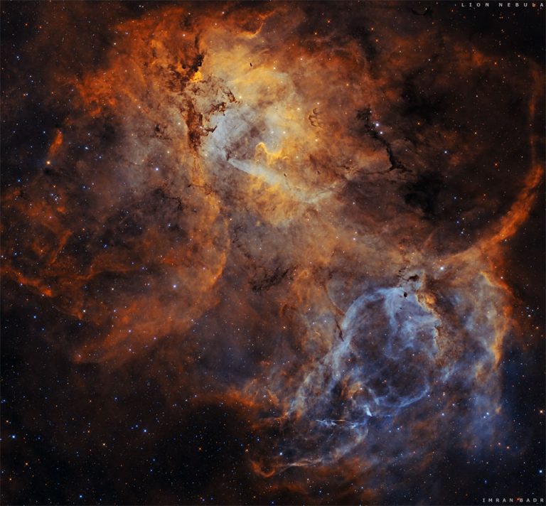
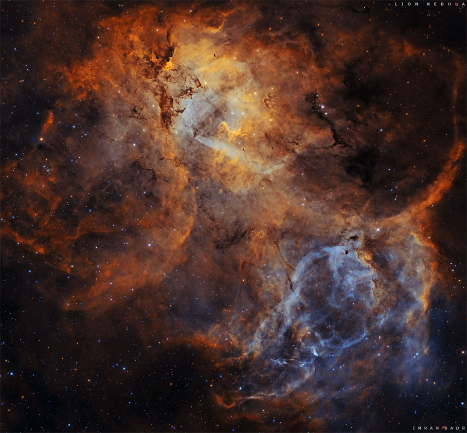
The Lion Nebula (Sh2-132)
Sh2-132: The Lion Nebula
Image Credit & Copyright: Imran Badr; Text: Natalia Lewandowska (SUNY Oswego)

Introduction

The universe is filled with fascinating and beautiful objects, and nebulae are among the most spectacular. These vast clouds of gas and dust serve as the birthplaces of stars, offering a glimpse into the dynamic processes that shape the cosmos. Today, we explore the Lion Nebula, also known as Sh2-132, located in the constellation Cepheus.

Lion Nebula Overview

The Lion Nebula, officially named Sh2-132, is a stunning region of ionized gas located in the constellation Cepheus. This nebula is powered by two massive stars, each with a mass over 20 times greater than our Sun. These stars energize the surrounding gas, causing it to glow brightly. The Lion Nebula’s angular size is slightly greater than that of the full moon, making it a prominent feature in the night sky for those with the right equipment to observe it.

The Lion Nebula is approximately 10,000 light years away from Earth. This vast distance means that the light we see from the nebula today actually left it 10,000 years ago. The nebula’s location in the constellation Cepheus, named after the King of Aethopia in Greek mythology, adds to its mystique and cultural significance.

Characteristics and Formation

The Lion Nebula is formed from shells of ionized gas that have expanded over time. These shells are the result of powerful stellar winds and radiation from the massive stars at the nebula’s core. As these energetic particles collide with the surrounding gas, they cause it to ionize and emit light, creating the beautiful glow that we see.

The matter within the Lion Nebula is not only energetic but also dense enough to contract gravitationally. This process can lead to the formation of new stars, making the Lion Nebula a stellar nursery. The cycle of star formation and destruction within nebulae like Sh2-132 is a crucial aspect of the cosmic lifecycle.

Table 1: Characteristics of the Lion Nebula (Sh2-132)

Characteristic Description
Name Lion Nebula (Sh2-132)
Location Constellation Cepheus
Distance from Earth 10,000 light years
Angular Size Slightly greater than the full moon
Central Stars Two massive stars, >20 times the mass of the Sun
Formation Process Shells of ionized gas expanding and contracting

Astronomical Significance

The Lion Nebula is a significant site for the study of star formation and the life cycles of stars. By observing regions like Sh2-132, astronomers can gain valuable insights into the processes that lead to the birth of stars and the distribution of elements in the galaxy.

Birthplaces of Stars

Nebulae like Sh2-132 are often referred to as stellar nurseries because they are regions where new stars are born. The dense regions of gas within the nebula can collapse under their own gravity, forming protostars. These protostars continue to accumulate mass from the surrounding gas and dust until they ignite nuclear fusion, becoming fully-fledged stars.

Sources of Heavy Elements

The massive stars within the Lion Nebula play a crucial role in the synthesis of heavy elements. Through the process of nuclear fusion, these stars convert hydrogen into heavier elements like helium, carbon, and oxygen. When these stars eventually die, they eject these elements into space, enriching the interstellar medium and providing the raw materials for future generations of stars and planets.

Galactic Recycling

The dynamic nature of nebulae like Sh2-132 highlights the concept of galactic recycling. The material ejected from dying stars is incorporated into new stars and planetary systems, driving the ongoing evolution of galaxies. This process ensures that the elements necessary for life are continuously replenished throughout the cosmos.

Observation Techniques

Telescopes

Telescopes are essential tools for observing nebulae. Ground-based telescopes, such as those at the Mauna Kea Observatories in Hawaii, provide detailed views of nebulae in visible light. Space telescopes, such as the Hubble Space Telescope, offer unparalleled clarity by avoiding the distortion caused by Earth’s atmosphere.

Spectroscopy

Spectroscopy involves analyzing the light from nebulae to determine their composition, temperature, density, and motion. By studying the spectra of nebulae, astronomers can learn about the physical conditions and processes occurring within them. This technique is particularly useful for identifying the presence of specific elements and molecules in the nebula.

Space Missions

Space missions have significantly enhanced our understanding of nebulae. The Hubble Space Telescope, launched in 1990, has captured stunning images of nebulae, revealing intricate details and structures. Upcoming missions, like the James Webb Space Telescope, promise to provide even deeper insights into these fascinating objects. These missions allow astronomers to observe nebulae in different wavelengths of light, including infrared and ultraviolet, which are not accessible from the ground.

Table 2: Observation Techniques for Nebulae

Technique Description Example
Telescopes Instruments that collect and magnify light from celestial objects Hubble Space Telescope
Spectroscopy Analysis of light to determine composition and physical properties Identifying elemental composition
Space Missions Missions that deploy telescopes and instruments in space James Webb Space Telescope

Historical and Cultural Context

The Lion Nebula’s location in the constellation Cepheus adds a rich layer of historical and cultural context to its scientific significance. Cepheus is named after the mythical King of Aethopia, a character from Greek mythology. This connection reflects the long-standing human tradition of naming celestial objects after mythological figures and stories.

In mythology, Cepheus was the husband of Cassiopeia and the father of Andromeda. The constellation bearing his name has been recognized since ancient times, highlighting the enduring human fascination with the night sky and the stories it holds.

Famous Nebulae for Comparison

The Lion Nebula is just one of many remarkable nebulae in the universe. Comparing it to other famous nebulae helps to appreciate its unique features and significance.

Orion Nebula

The Orion Nebula (M42) is one of the most famous and easily visible nebulae in the night sky. Located in the constellation Orion, it is a stellar nursery where new stars are being born. The nebula is about 1,344 light years away and spans about 24 light years. Its vibrant colors and intricate structures make it a popular target for amateur and professional astronomers alike.

Eagle Nebula

The Eagle Nebula (M16) is home to the famous “Pillars of Creation,” towering columns of gas and dust where new stars are forming. Located in the constellation Serpens, it is about 7,000 light years away. The Hubble Space Telescope’s images of the Eagle Nebula have become iconic, showcasing the dramatic and awe-inspiring nature of star formation.

Crab Nebula

The Crab Nebula (M1) is the remnant of a supernova explosion observed in 1054 AD. Located in the constellation Taurus, it is about 6,500 light years away. The nebula is expanding at a rate of about 1,500 kilometers per second, providing a dynamic laboratory for studying the aftermath of stellar explosions.

Conclusion

The Lion Nebula (Sh2-132) is a powerful and majestic nebula located in the constellation Cepheus. Powered by two massive stars, it serves as a stellar nursery where new stars are born. Its formation from shells of ionized gas and its role in the galactic recycling process highlight the dynamic and ever-changing nature of the cosmos.

Hashtags:

#LionNebula, #Astronomy, #StarFormation, #Cepheus, #Nebulae, #SpaceExploration, #Astrophysics, #Cosmos, #HubbleSpaceTelescope, #JamesWebbSpaceTelescope #space photo by nasa

Japanese Wooden Satellite: Launch Date and Key Details

Key Takeaway

Japan is set to launch the first wooden satellite, LignoSat, in September 2024. Developed by Kyoto University and Sumitomo Forestry, this innovative satellite aims to explore the viability of wood as a sustainable material for space applications, with the potential to reduce environmental impact and inspire future wooden habitats on the Moon and Mars.

Summary

  • Launch Date: September 2024
  • Satellite Name: LignoSat
  • Developers: Kyoto University and Sumitomo Forestry
  • Size: 4 inches (10 centimeters) on a side
  • Weight: Just over 2 pounds (0.9 kilograms)
  • Material: Magnolia wood
  • Purpose: To study wood’s behavior in space, including expansion, contraction, and degradation
  • Potential Impact: Reduce harmful metal particles from satellite reentries and expand wood’s use as a sustainable resource
  • Long-Term Vision: Building wooden habitats on the Moon and Mars

Japanese Wooden Satellite

Introduction

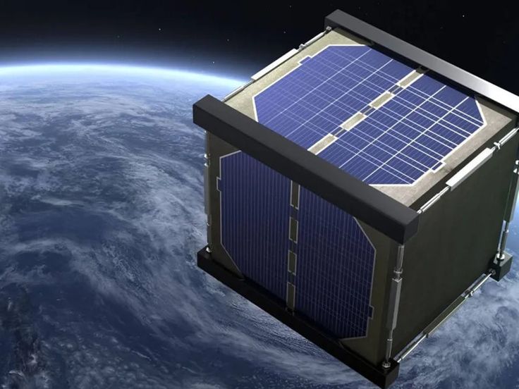
In a groundbreaking move, Japan is poised to launch the world’s first wooden satellite, LignoSat, into space this September. This innovative project is the brainchild of researchers at Kyoto University and the Japanese logging company Sumitomo Forestry. The satellite is a small cube, measuring just 4 inches (10 centimeters) on each side and weighing a mere 2 pounds (0.9 kilograms). LignoSat’s development marks a significant milestone in space technology, highlighting the potential of wood as a sustainable material for future space applications.

Development and Design

The idea of using wood in space might seem unconventional, but it stems from a broader vision of sustainability and environmental responsibility. Takao Doi, an astronaut and professor at Kyoto University, emphasized the significance of this project:

“Expanding the potential of wood as a sustainable resource is significant. We aim to build human habitats using wood in space, such as on the moon and Mars, in the future.”

Magnolia wood was chosen for LignoSat after rigorous space exposure tests on different types of wood, including cherry and birch. Magnolia’s strength and workability made it the ideal candidate. The satellite’s design leverages a traditional Japanese woodworking technique that avoids the use of screws or glue, ensuring the structure is both robust and lightweight.

LignoSat is equipped with external solar panels to power its onboard instruments. Despite its small size, the satellite is designed to withstand the harsh conditions of space. Researchers will monitor its performance closely, focusing on wood expansion, contraction, degradation, internal temperature, and the performance of electronic equipment.

Environmental Impact

One of the primary motivations behind LignoSat is to address the growing concern of space debris. Traditional satellites, when they re-enter Earth’s atmosphere and burn up, release harmful metal particles. By contrast, a wooden satellite like LignoSat would minimize this environmental impact. If successful, this approach could pave the way for more eco-friendly satellite designs.

The success of LignoSat could open new avenues for using wood in space. This aligns with broader efforts to promote sustainable practices in various industries. The concept of wooden habitats on the Moon and Mars is particularly intriguing. Such structures could potentially be easier to construct and maintain, leveraging the natural properties of wood.

Launch and Deployment

The development of LignoSat began in April 2020. Since then, extensive ground tests have been conducted to ensure the satellite’s functionality and safety. These tests included exposing wood samples to space-like conditions to study their behavior. The results were promising, demonstrating that wood could endure the rigors of space.

Mission Timeline

LignoSat is scheduled to be launched to the International Space Station (ISS) in September 2024. About a month after its arrival, it will be deployed from the Japanese Kibo module into orbit. This deployment marks a critical phase where researchers will begin collecting data on how the wooden satellite performs in space.

Potential Challenges

While wood has many desirable properties, its behavior in the extreme environment of space is not fully understood. Space is characterized by intense radiation, vacuum conditions, and extreme temperature fluctuations. Researchers will closely monitor how LignoSat copes with these challenges, providing valuable insights for future wooden structures in space.

Integrating modern technology with traditional materials like wood poses unique challenges. Ensuring that electronic components function correctly within a wooden structure requires careful design and testing. The success of LignoSat will depend on the seamless integration of these technologies.

Future Prospects

The long-term vision for projects like LignoSat is to build sustainable habitats on the Moon and Mars. Wood, with its natural insulation properties and structural versatility, could be an excellent material for constructing living quarters and research stations. This could reduce the need for transporting heavy construction materials from Earth, making space colonization more feasible.

If LignoSat proves successful, it could inspire further innovations in the use of wood in space technology. This might include wooden components for other types of spacecraft, satellites, or even tools and equipment for astronauts. The potential applications are vast, highlighting the versatility of this ancient material in modern space exploration.

Conclusion

Japan’s launch of the world’s first wooden satellite, LignoSat, represents a pioneering step in space technology and sustainability. Developed by Kyoto University and Sumitomo Forestry, this innovative project explores the potential of wood as a viable material for space applications. By reducing environmental impact and paving the way for future wooden habitats on the Moon and Mars, LignoSat could significantly influence the future of space exploration. As we look forward to its launch in September 2024, the world will be watching closely to see how this unique satellite performs in the final frontier.

Tables

Table 1: LignoSat Specifications

Feature Details
Name LignoSat
Dimensions 4 inches (10 cm) per side
Weight 2 pounds (0.9 kg)
Material Magnolia wood
Launch Date September 2024
Developers Kyoto University, Sumitomo Forestry
Power Source External solar panels

Table 2: Potential Benefits of Wooden Satellites

Benefit Description
Environmental Impact Reduces harmful metal particles during re-entry
Sustainability Promotes the use of renewable materials
Construction Feasibility Easier to construct and maintain wooden structures in space
Cost Efficiency Potentially lower transportation and construction costs
Innovation in Space Technology Opens new avenues for integrating traditional materials in space tech

Hashtags

#SpaceExploration, #Sustainability, #WoodenSatellite, #LignoSat, #Japan, #KyotoUniversity, #SumitomoForestry, #SpaceDebris, #EnvironmentalImpact, #InnovativeTechnology

Japanese Aerospace Exploration Agency: Lunar Lander Fails to Check In

Key Takeaways

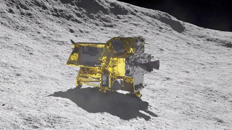
The Japanese Aerospace Exploration Agency (JAXA) successfully landed its Smart Lander for Investigating Moon (SLIM) on January 19th, 2024. JAXA is the fifth national space agency to achieve a soft landing on the Moon. SLIM faced technical difficulties, including upending shortly after landing and power issues during lunar nights. SLIM survived three consecutive lunar nights but lost communication on May 27th, 2024. JAXA plans to attempt reestablishing communication after the current lunar night ends. SLIM’s mission included two rovers, LEV-1 and LEV-2, which continue to transmit data independently.

Summary

  • January 19th, 2024: JAXA’s SLIM lands on the Moon.
  • JAXA: Becomes the fifth space agency to land on the Moon.
  • Technical Issues: SLIM upended shortly after landing and faced power problems.
  • Lunar Cycle: Moon’s day/night cycle impacts solar panel-based missions.
  • SLIM’s Survival: Survived three lunar nights but lost contact on May 27th, 2024.
  • Communication Efforts: JAXA uses an unplanned ground station antenna for reestablishing contact.
  • Future Plans: Attempt to reestablish communication post-lunar night.
  • Rovers: LEV-1 and LEV-2, separated from SLIM, operate autonomously and continue to send data.

The SLIM Mission: An Overview

On January 19th, 2024, the Japanese Aerospace Exploration Agency (JAXA) achieved a significant milestone by successfully landing its Smart Lander for Investigating Moon (SLIM) on the lunar surface. This achievement placed JAXA among the elite group of national space agencies that have accomplished a soft landing on the Moon. The other agencies in this distinguished group are NASA, the Soviet space program (Interkosmos), the European Space Agency (ESA), and the China National Space Agency (CNSA).

SLIM’s Technical Difficulties

Despite the successful landing, SLIM experienced several technical difficulties shortly after its arrival on the lunar surface. One of the initial challenges was the lander upending itself, which posed significant risks to its stability and operation. Furthermore, as the lunar night approached, SLIM began to experience power issues.

On the Moon, a single day or night lasts for about fourteen Earth days. This prolonged darkness significantly affects missions that rely on solar panels for power. Nevertheless, SLIM managed to reorient its solar panels and recharge its batteries, allowing it to survive three consecutive lunar nights. However, on May 27th, 2024, JAXA announced that they had lost communication with SLIM as another lunar night began.

Communication Challenges

JAXA’s official statement, released via its X account (formerly Twitter), explained the situation:

The command transmission to restore communication was performed using an unplanned ground station antenna, with the cooperation of JAXA’s tracking network. The agency hopes to reestablish communication once the current lunar night ends later this month, expecting that the lander will recharge and reset itself.

SLIM’s Rovers: LEV-1 and LEV-2

In addition to the main lander, the SLIM mission included two rovers: the Lunar Excursion Vehicle-1 (LEV-1) and Lunar Excursion Vehicle-2 (LEV-2). These rovers separated from SLIM in lunar orbit and landed independently on the same day. LEV-1 is celebrated as the world’s first “hopping exploration rover,” while LEV-2 is the world’s smallest and lightest rover.

Rover Missions

During the four months since their landing, LEV-1 has conducted various scientific operations, including measuring local temperatures, mapping topography, and capturing images of the lunar surface. The rovers operate autonomously and can transmit data to Earth without relying on the SLIM lander. Consequently, even as JAXA works to restore communication with SLIM, they continue to receive valuable data from LEV-1 and LEV-2.

The Importance of SLIM’s Mission

The SLIM mission represents a significant step forward in lunar exploration for Japan and contributes valuable scientific data to the global community. By successfully landing and deploying autonomous rovers, JAXA has demonstrated its capability to conduct complex space missions and gather crucial information about the Moon’s environment.

Table 1: Key Events of the SLIM Mission

Date Event
January 19th, 2024 SLIM lands on the Moon
February 2024 SLIM reorients solar panels
March 2024 SLIM survives first lunar night
April 2024 SLIM survives second lunar night
May 27th, 2024 SLIM loses communication

Challenges and Future Prospects

The challenges faced by SLIM feature the essential difficulties of space exploration, particularly missions to the Moon. The harsh lunar environment, with its extreme temperature variations and prolonged periods of darkness, presents significant obstacles for any mission relying on solar power.

However, the experience gained from the SLIM mission will undoubtedly inform future lunar exploration efforts by JAXA and other space agencies. The successful operation of the LEV-1 and LEV-2 rovers, despite the issues faced by SLIM, highlights the potential for robotic exploration and the importance of redundancy in mission design.

JAXA’s Commitment to Lunar Exploration

JAXA’s ongoing efforts to restore communication with SLIM demonstrate its commitment to the mission and the broader goal of lunar exploration. As the agency works to overcome these challenges, the data collected by the rovers continues to provide valuable insights into the lunar environment.

Table 2: SLIM Mission Scientific Objectives

Objective Description
Surface Imaging Capture high-resolution images of the lunar surface
Temperature Measurement Record local temperature variations
Topography Mapping Create detailed maps of the lunar terrain
Autonomous Navigation Test the rovers’ ability to navigate the lunar surface autonomously
Environmental Data Collection Gather data on the lunar environment

As JAXA awaits the end of the current lunar night to attempt reestablishing communication with SLIM, the mission’s scientific achievements and the operational success of the rovers remain a testament to the agency’s capabilities. The insights gained from this mission will pave the way for future lunar exploration and contribute to our understanding of the Moon.

In conclusion, the Japanese Aerospace Exploration Agency’s SLIM mission marks a significant milestone in lunar exploration. Despite the technical difficulties faced by the lander, the successful operation of the autonomous rovers continues to provide valuable data. JAXA’s efforts to restore communication with SLIM stress their commitment to overcoming challenges and advancing our understanding of the lunar environment.

Hashtags

#JAXA, #LunarMission, #SLIM, #LunarExploration, #SpaceExploration, #MoonMission, #SpaceScience, #RoboticExploration, #LunarRovers, #SpaceTechnology, #ScientificResearch, #JapanSpaceAgency

Space Facts: Understanding Outer Space and Its Boundaries

Key Takeaways

Space is an incredibly vast and largely unexplored region that extends beyond Earth’s atmosphere. Our solar system is home to a diverse collection of celestial objects, including planets, moons, asteroids, and comets. The universe is estimated to be 13.8 billion years old and contains approximately 2 trillion galaxies. Significant discoveries and explorations have been made, enhancing our understanding of space and its many mysteries.

Summary

  • Space does not have a definitive boundary, but the Kármán line at 100 km is often used as a marker.
  • Temperatures in space are extremely cold, around −270.45 °C.
  • Space is a vacuum with very little matter and no sound.
  • There are about 100-400 billion stars in the Milky Way galaxy.
  • The universe is expanding and is about 13.8 billion years old.
  • There are roughly 2 trillion galaxies in the observable universe.
  • The International Space Station is the largest man-made object in space.
  • Spacecraft have visited all known planets in our solar system.

Introduction

Space, the final frontier, has captivated human imagination and scientific inquiry for centuries. From ancient astronomers to modern astrophysicists, the quest to understand the cosmos has driven countless explorations and discoveries.

The Planets

Mercury

Mercury, the smallest planet in our solar system, completes an orbit around the Sun in just 88 Earth days. Due to its proximity to the Sun, Mercury’s surface temperatures can soar to a scorching 427°C during the day, while at night, they can plummet to a frigid -173°C. Despite its extreme temperatures, Mercury has a surprisingly thin atmosphere composed of oxygen, sodium, and hydrogen. The planet’s surface is heavily cratered, resembling our Moon, and it lacks any moons of its own.

Venus

Venus, often referred to as Earth’s twin because of its similar size and mass, is an enigma. Its thick, toxic atmosphere is composed mostly of carbon dioxide, with clouds of sulfuric acid, creating a runaway greenhouse effect. This makes Venus the hottest planet in our solar system, with surface temperatures reaching 467°C. The planet rotates on its axis very slowly and in the opposite direction of most planets, causing its day to be longer than its year.

Earth

Earth, our home, is unique in its ability to support life. It has a diverse climate system, abundant liquid water, and a protective atmosphere composed mainly of nitrogen and oxygen. Earth’s magnetic field and atmosphere shield it from harmful solar and cosmic radiation, making it a hospitable environment for a wide variety of life forms. Earth has one natural satellite, the Moon, which has a significant impact on the planet’s tides and stabilizes its axial tilt.

Mars

Mars, the fourth planet from the Sun, has long fascinated humanity. Known as the Red Planet due to its iron oxide-rich soil, Mars has the largest volcano in the solar system, Olympus Mons, and the deepest canyon, Valles Marineris. Mars’ thin atmosphere, composed mostly of carbon dioxide, cannot retain heat, resulting in temperature extremes from -125°C at the poles to 20°C at the equator. Recent missions have found evidence of liquid water in the past, raising the possibility of ancient life.

Jupiter

Jupiter, the largest planet in our solar system, is a behemoth composed primarily of hydrogen and helium. Its massive size means it has a strong magnetic field and dozens of moons, including the four largest—Io, Europa, Ganymede, and Callisto—discovered by Galileo Galilei. Jupiter’s atmosphere is marked by colorful bands and the Great Red Spot, a gigantic storm that has raged for centuries.

Saturn

Saturn, the sixth planet from the Sun, is renowned for its spectacular ring system, composed of ice and rock particles. Like Jupiter, Saturn is a gas giant made mostly of hydrogen and helium. It has 83 moons, with Titan being the largest. Titan has a thick atmosphere and lakes of liquid methane and ethane, making it a fascinating object of study for scientists exploring the potential for life in extreme conditions.

Uranus

Uranus is an ice giant with a unique feature—its axis is tilted at an angle of about 98 degrees, causing it to rotate on its side. This unusual tilt results in extreme seasonal variations. Uranus’ atmosphere contains hydrogen, helium, and methane, which gives the planet its characteristic blue-green color. It has 27 known moons, with Miranda and Titania being the most notable for their extreme geological features.

Neptune

Neptune, the farthest planet from the Sun, is known for its dynamic atmosphere and incredibly strong winds, the fastest in the solar system. Like Uranus, Neptune is an ice giant with a bluish appearance due to methane in its atmosphere. It has 14 known moons, with Triton being the largest. Triton is geologically active, with geysers that spew nitrogen gas, and it has a retrograde orbit, suggesting it was captured by Neptune’s gravity.

The Solar System

The Asteroid Belt

The asteroid belt, situated between Mars and Jupiter, is a region filled with millions of rocky bodies. These asteroids vary in size from tiny pebbles to Ceres, the largest object in the belt, which is also classified as a dwarf planet. The asteroid belt represents remnants from the early solar system that never coalesced into a planet, providing scientists with valuable insights into the solar system’s formation.

The Kuiper Belt

The Kuiper Belt extends beyond Neptune’s orbit and is populated with icy bodies and dwarf planets, including Pluto. This region is similar to the asteroid belt but is much larger and contains objects composed mainly of frozen volatiles like methane, ammonia, and water. The Kuiper Belt is the source of many short-period comets that occasionally become visible from Earth.

The Oort Cloud

The Oort Cloud is a theoretical distant cloud of icy bodies that surrounds the solar system. It is believed to be the source of long-period comets that take thousands of years to complete an orbit around the Sun. The Oort Cloud marks the boundary of the Sun’s gravitational influence and the beginning of interstellar space.

The Sun

The Sun, a G-type main-sequence star, is the central and most massive object in our solar system. It provides the energy necessary for life on Earth through the process of nuclear fusion, where hydrogen atoms are fused into helium, releasing immense amounts of energy. The Sun’s surface, or photosphere, has a temperature of about 5,500°C, while its core can reach temperatures of 15 million°C.

Solar Eclipses

Solar eclipses occur when the Moon passes between the Earth and the Sun, casting a shadow on Earth. There are three types of solar eclipses: total, partial, and annular. A total eclipse, where the Sun is completely obscured by the Moon, is a rare and awe-inspiring event. An annular eclipse occurs when the Moon is too far from Earth to completely cover the Sun, creating a ring-like appearance.

Comets, Asteroids, Meteorites, and Meteor Showers

Comets

Comets are icy bodies that originate from the Kuiper Belt or Oort Cloud. As they approach the Sun, their ices vaporize, creating a glowing coma and a tail that can stretch millions of kilometers. Comets have highly elliptical orbits, bringing them close to the Sun before they swing back into the outer solar system. Famous comets include Halley’s Comet, which returns to the inner solar system every 76 years.

Asteroids

Asteroids are rocky objects that orbit the Sun, primarily found in the asteroid belt. They vary greatly in size, and some have even been classified as dwarf planets. Asteroids can provide valuable information about the early solar system, and some, like Ceres, have shown signs of water, suggesting they could harbor conditions favorable for life.

Meteorites

Meteorites are fragments of asteroids or comets that survive their passage through Earth’s atmosphere and land on the surface. They are classified into three main types: stony, iron, and stony-iron meteorites. Studying meteorites allows scientists to gain insights into the composition and history of the solar system.

Meteor Showers

Meteor showers occur when Earth passes through the debris trail left by a comet. As these small particles enter Earth’s atmosphere, they burn up, creating bright streaks of light in the sky. Some of the most well-known meteor showers include the Perseids, which peak in August, and the Geminids, which occur in December.

Comet passing in front of planet earth (3D uv map from http://visibleearth.nasa.gov)

Moons

The Moon: Earth’s Companion

Earth’s Moon is the fifth-largest moon in the solar system and has a significant impact on our planet. It influences ocean tides, stabilizes Earth’s axial tilt, and has been a source of inspiration and study for millennia. The Moon’s surface is marked by impact craters, maria (large basaltic plains), and mountains. The Apollo missions of the 1960s and 1970s brought humans to the Moon, providing a wealth of scientific data and samples.

Mars’ Moons: Phobos and Deimos

Mars has two small moons, Phobos and Deimos, thought to be captured asteroids from the asteroid belt. Phobos orbits very close to Mars and is slowly spiraling inward, while Deimos orbits further away. Phobos, with its irregular shape and surface covered in grooves and craters, is gradually getting closer to Mars and may eventually crash into the planet or break apart.

The Galilean Moons: Jupiter’s Largest Satellites

Jupiter’s four largest moons—Io, Europa, Ganymede, and Callisto—were discovered by Galileo Galilei in 1610. Io is the most volcanically active body in the solar system, while Europa is believed to have a subsurface ocean that may harbor life. Ganymede, the largest moon in the solar system, has its magnetic field, and Callisto’s heavily cratered surface hints at a long and complex history.

Saturn’s Moons

Saturn’s moons include Titan, Enceladus, and many others. Titan, the largest, has a thick atmosphere and lakes of liquid methane and ethane, making it a target for future exploration. Enceladus, with its geysers that eject water ice and organic molecules, has drawn interest due to the potential for life in its subsurface ocean.

Uranus and Neptune’s Moons

Uranus’ moons, like Miranda and Titania, are known for their extreme geological features, such as cliffs and valleys. Neptune’s moon Triton has geysers that spew nitrogen gas and a retrograde orbit, indicating it was likely captured by Neptune’s gravity.

Dwarf Planets

Ceres: The Largest Asteroid

Ceres, located in the asteroid belt, is the only dwarf planet in the inner solar system. It has a differentiated interior with a rocky core and an icy mantle. Observations from the Dawn spacecraft revealed bright spots on its surface, believed to be deposits of sodium carbonate.

Pluto: A Dwarf Planet with a Heart

Pluto, once considered the ninth planet, is now classified as a dwarf planet. It has five known moons, with Charon being the largest. Pluto’s surface features mountains, valleys, plains, and craters, and the New Horizons mission provided stunning images and data about this distant world.

Haumea, Makemake, and Eris: Remote Worlds

These distant dwarf planets, located in the Kuiper Belt, have unique characteristics. Haumea has a rapid rotation and an elongated shape, Makemake is known for its lack of atmosphere, and Eris is one of the most massive dwarf planets, even more massive than Pluto.

Galaxies

The Milky Way: Our Galactic Home

The Milky Way is a barred spiral galaxy containing our solar system. It has a diameter of about 100,000 light-years and is home to approximately 100-400 billion stars. Our solar system is located in one of the spiral arms, about 27,000 light-years from the galactic center.

Andromeda: The Nearest Spiral Galaxy

The Andromeda Galaxy, the nearest spiral galaxy to the Milky Way, is on a collision course with our galaxy. This merger is expected to occur in about 4.5 billion years, resulting in a new galaxy often referred to as “Milkomeda.”

Other Notable Galaxies

  • Sombrero Galaxy: Known for its bright nucleus and large central bulge, resembling a sombrero hat.
  • Whirlpool Galaxy: Famous for its well-defined spiral arms and interaction with a companion galaxy.
  • Triangulum Galaxy: The third-largest galaxy in the Local Group, it is a face-on spiral galaxy.
  • Magellanic Clouds: Two irregular dwarf galaxies orbiting the Milky Way, visible from the Southern Hemisphere.
  • Pinwheel Galaxy: A face-on spiral galaxy in the constellation Ursa Major, known for its symmetrical structure.
  • Messier 87: A giant elliptical galaxy with a supermassive black hole at its center, famous for its jet of energetic particles.
  • Antennae Galaxies: A pair of interacting galaxies in the process of merging, creating a spectacular array of star-forming regions.

What is Outer Space?

Outer space is the vast expanse beyond Earth’s atmosphere. It is a near-perfect vacuum, devoid of air and with extremely low pressure and temperatures. Despite its emptiness, space is teeming with activity, from the movement of galaxies to the formation of stars and planets.

Interesting Facts about Space

  1. No definitive boundary: Space does not begin at a specific altitude above Earth, but the Kármán line at 100 km is a commonly used definition.
  2. Extremely cold temperatures: The temperature in the void of space is about −270.45 °C.
  3. Hard vacuum: Space is a void containing very little matter.
  4. No sound: There is no sound in space because molecules are too far apart to transmit sound.
  5. Sparse matter: The space between galaxies is not completely empty but has an average of one atom per cubic meter.
  6. Numerous stars: There are an estimated 100-400 billion stars in our galaxy, the Milky Way.
  7. Old and expanding universe: The universe is observed to be 13.8 billion years old and has been expanding since its formation in the Big Bang.
  8. Countless galaxies: In the observable universe, there are an estimated 2 trillion galaxies.
  9. International Space Station: The largest ever crewed object in space.
  10. Planetary exploration: Spacecraft have visited all the known planets in our solar system.

Tables

Table 1: Characteristics of the Planets

Planet Distance from Sun (AU) Diameter (km) Atmosphere Composition Average Temperature (°C)
Mercury 0.39 4,880 Oxygen, Sodium, Hydrogen -173 to 427
Venus 0.72 12,104 Carbon Dioxide, Nitrogen 467
Earth 1.00 12,742 Nitrogen, Oxygen 15
Mars 1.52 6,779 Carbon Dioxide, Argon -125 to 20
Jupiter 5.20 139,820 Hydrogen, Helium -145
Saturn 9.58 116,460 Hydrogen, Helium -178
Uranus 19.22 50,724 Hydrogen, Helium, Methane -224
Neptune 30.05 49,244 Hydrogen, Helium, Methane -214

Table 2: Notable Moons in the Solar System

Moon Planet Diameter (km) Notable Features
Moon Earth 3,474 Influences tides, stabilizes Earth’s tilt
Phobos Mars 22.4 Gradually getting closer to Mars
Deimos Mars 12.4 Smaller and more distant than Phobos
Io Jupiter 3,643 Most volcanically active body in the solar system
Europa Jupiter 3,121 Possible subsurface ocean
Ganymede Jupiter 5,268 Largest moon in the solar system
Callisto Jupiter 4,821 Heavily cratered surface
Titan Saturn 5,151 Thick atmosphere, liquid methane lakes
Enceladus Saturn 504 Geysers ejecting water ice
Triton Neptune 2,707 Retrograde orbit, geologically active

Conclusion

The exploration and study of space continue to expand our understanding of the universe and our place within it. From the planets in our solar system to the countless galaxies beyond, space holds endless mysteries and opportunities for discovery. As our technology and knowledge advance, so too will our ability to explore and understand the vast cosmos that surrounds us. The journey of space exploration is far from over, promising new adventures and revelations in the years to come.

Hashtags

#SpaceFacts, #Astronomy, #Planets, #SolarSystem, #Galaxies, #Cosmos, #SpaceExploration, #Universe, #Asteroids, #Comets

Earth-like Exoplanets: Finding Earth 2.0 with Advanced Deep Learning

Key Takeaways

Machine learning, particularly neural network-based algorithms, can significantly improve the detection of Earth-like exoplanets. Radial Velocity (RV) detection method is crucial in identifying exoplanets but is challenged by stellar activity from host stars.The study aimed to reduce the impact of stellar activity data to identify low-mass and long-period planets. Successful identification of exoplanets was demonstrated on stars like our Sun, Alpha Centauri B, and Tau Ceti. Upcoming missions like ESA’s PLATO space telescope could further enhance the discovery of terrestrial exoplanets.

Summary

  • Machine learning is a powerful tool for handling large datasets in astronomy.
  • Algorithms can be divided into supervised and unsupervised learning.
  • Supervised learning models are advantageous for their accuracy.
  • Researchers applied their novel algorithm to data from our Sun, Alpha Centauri B, and Tau Ceti.
  • Simulated planetary signals were successfully identified with varying orbital periods.
  • Potential exoplanets in Alpha Centauri B and Tau Ceti’s habitable zones were approximately four times the size of Earth.
  • Further analysis showed the algorithm could detect a simulated exoplanet 2.2 times the size of Earth, orbiting at a similar distance.
  • The PLATO mission, launching in 2026, will play a significant role in discovering Earth-like exoplanets.

Introduction

The search for Earth-like exoplanets has always fascinated scientists and the public alike. The discovery of planets beyond our solar system, particularly those that could potentially harbor life, is one of the most exciting frontiers in astronomy. With the advent of advanced deep learning technologies, the ability to detect these elusive planets has significantly improved. This article explores how machine learning, especially neural network-based algorithms, is revolutionizing the hunt for Earth 2.0 using data from the radial velocity (RV) detection method.

Machine Learning in Astronomy

Machine learning (ML) has proven to be a revolutionary tool in various scientific fields, and astronomy is no exception. The ability of ML to handle and process vast amounts of data makes it ideal for tasks like exoplanet detection. The study under discussion highlights the efficiency and success of ML in mitigating stellar activity, a major challenge in identifying low-mass and long-period exoplanets within RV data.

Supervised vs. Unsupervised Learning

Machine learning algorithms are generally categorized into two types: supervised learning and unsupervised learning. Supervised learning involves training a model on a labeled dataset, which means the algorithm learns from data that already includes the correct output. This approach is highly effective in producing accurate predictions based on the training data. In contrast, unsupervised learning deals with unlabeled data, where the model tries to identify patterns and relationships without prior knowledge of the correct output.

The study emphasizes the advantages of supervised learning models in the context of exoplanet detection. These models, due to their ability to incorporate a large set of variables, can produce relatively accurate predictions and are particularly useful in dealing with the complexities of stellar activity data.

The Study: A Novel Neural Network-Based Algorithm

The recent study accepted by Astronomy & Astrophysics investigated a novel neural network-based algorithm designed to detect Earth-like exoplanets using RV data. The researchers applied their algorithm to data from three stars: our Sun, Alpha Centauri B (HD 128621), and Tau Ceti (HD 10700). These stars were chosen for their proximity and significance in exoplanet research.

Simulated Planetary Signals

To test the algorithm, the researchers inserted simulated planetary signals into the stellar activity data of these stars. The results were promising, with the algorithm successfully identifying simulated exoplanets with potential orbital periods ranging between 10 to 550 days for our Sun, 10 to 300 days for Alpha Centauri B, and 10 to 350 days for Tau Ceti.

Key Findings

  1. Alpha Centauri B: Located approximately 4.3 light-years from Earth, this star has had several potential exoplanet detections, although none have been confirmed. The algorithm identified potential exoplanets approximately four times the size of Earth within the habitable zone of Alpha Centauri B.
  2. Tau Ceti: Located about 12 light-years away, Tau Ceti currently has eight exoplanets listed as “unconfirmed.” The algorithm identified similar potential exoplanets within the habitable zone of Tau Ceti.
  3. Our Sun: The algorithm demonstrated its ability to identify a simulated exoplanet approximately 2.2 times the size of Earth, orbiting at a distance similar to Earth’s distance from the Sun.

Table 1: Key Findings from the Study

Star Distance from Earth (light-years) Detected Exoplanet Size (Earth Mass) Orbital Period (days) Notes
Alpha Centauri B 4.3 4x 10 to 300 Potential exoplanets in the habitable zone
Tau Ceti 12 4x 10 to 350 Eight unconfirmed exoplanets
Our Sun N/A 2.2x 10 to 550 Simulated exoplanet in a similar orbit

Implications and Future Prospects

The implications of this study are profound. By efficiently reducing stellar activity data, the neural network framework developed by the researchers can significantly enhance the detection of low-mass planets on periods from a few days up to a few hundred days. This corresponds to the habitable zones of solar-type stars, increasing the chances of finding Earth-like exoplanets.

Integration with Other Data

While the study focused on RV data, the researchers noted that additional data types could be integrated to improve detection accuracy. These include:

  • Transit Time: Observing the dimming of a star as a planet passes in front of it.
  • Phase: Studying the changes in light as a planet orbits its star.
  • Space-Based Photometry: Using telescopes to measure the brightness of stars.

The European Space Agency’s PLATO (PLAnetary Transits and Oscillations of stars) mission, set for launch in 2026, is particularly promising. PLATO will use the transit method to scan up to one million stars, focusing on terrestrial (rocky) exoplanets.

Table 2: Upcoming Missions and Their Objectives

Mission Launch Year Method Objectives
PLATO 2026 Transit Discovering terrestrial exoplanets using space-based photometry
TESS 2018 Transit Surveying bright stars for transiting exoplanets
James Webb 2021 Various Observing exoplanet atmospheres and characterizing their properties
CHEOPS 2019 Transit Characterizing known exoplanets by measuring their sizes

Conclusion

The study underlines the transformative potential of machine learning in the quest to find Earth-like exoplanets. By developing a neural network-based algorithm that can effectively mitigate stellar activity data, researchers have taken a significant step forward in identifying low-mass and long-period exoplanets within the habitable zones of solar-type stars.

As technology advances and more data becomes available from missions like PLATO, the potential for discovering Earth 2.0 increases. Machine learning will undoubtedly play a crucial role in this endeavor, helping astronomers to sift through vast amounts of data and pinpoint the most promising candidates for further study.

In the coming years and decades, the integration of machine learning with advanced astronomical techniques promises to revolutionize our understanding of the universe and our place within it. As the study aptly concludes, “Only time will tell, and this is why we science!”

Hashtags

#Exoplanets, #MachineLearning, #Astronomy, #RadialVelocity, #DeepLearning, #NeuralNetworks, #PLATO, #SpaceExploration, #EarthLikePlanets, #Astrophysics

About The Moon Today: Breakthroughs in Creating Detailed Lunar Maps

Key Takeaways

Researchers at Brown University have enhanced the technique of creating lunar maps using satellite images. The advanced method, known as ‘shape-from-shading’, analyzes shadows to estimate terrain features and shapes. Detailed lunar maps are critical for safe and efficient future lunar missions. The Artemis project, aiming for the Moon’s south pole, will benefit greatly from these high-resolution maps. New algorithms automate image alignment and quality control, significantly improving map accuracy.

Summary

  • Enhanced Technique: Brown University researchers improved the ‘shape-from-shading’ method for creating lunar maps.
  • Importance of Maps: High-resolution maps are crucial for lunar missions to identify safe landing sites and areas of interest.
  • Automation and Accuracy: Advanced algorithms automate the process, align images accurately, and filter poor-quality images.
  • Validation: The new technique produces more precise maps compared to traditional methods.
  • Future Missions: Projects like Artemis will benefit from these detailed maps, especially in poorly mapped areas like the Moon’s south pole.

Breakthroughs in Creating Detailed Lunar Maps

There was a time when maps of the Moon were created from telescopic observations and drawings. Indeed, Sir Patrick Moore created maps of the Moon that were used during the historic Apollo landings. Today, researchers have developed a sophisticated technique to create accurate maps from existing satellite images. This approach, known as ‘shape-from-shading’, involves analyzing shadows to estimate the features and shape of the terrain. Future lunar missions will be able to use these maps to identify hazards on the surface, making them far safer.

Advancements at Brown University

Researchers at Brown University in Rhode Island have refined the process used to map the surface of the Moon, making it more accurate than ever before. Their paper, published in the Planetary Science Journal and authored by Benjamin Boatwright and his team, details the enhancements to the mapping technique. This technique can generate detailed models of the Moon’s surface to highlight craters, ridges, and slopes from composites of 2D images.

Highly detailed maps are of crucial importance to lunar missions as they help planners identify the safest places to land. They can also pinpoint areas of particular interest that require further study, enabling the entire mission to be far more efficient. Missions such as the Artemis project will benefit significantly when it heads for the south pole of the Moon, an area that is not well mapped. High-resolution maps of this region will aid autonomous landing systems in avoiding hazards.

Challenges and Solutions

Creating these maps is a time-consuming job and is particularly challenging when lighting levels in the target area are poor. Previously, the interpretation of shadows was less effective, but the team at Brown University addressed these issues. In their paper, they explain how advanced computer algorithms can automate much of the process and improve the resolution of the generated models. Their new software provides lunar astronomers with the necessary tools and information to create larger, more detailed maps of the surface.

To allow lunar scientists to create a map from images, at least two images of the same area are required. Each image must be perfectly aligned with its counterpart so that features in one are in the exact same place in the other. Until now, the technology has not been able to take multiple images of an area and create a perfect map. Boatwright stated, “We implemented an image alignment algorithm where it picks out features in one image and tries to find those same features in the other and then line them up, so that you’re not having to sit there manually tracing interest points across multiple images, which takes a lot of hours and brainpower.”

Along with the image alignment algorithm, the researchers created quality control algorithms and filters to remove poor-quality images from the alignment process. By only inputting high-quality images into the process, the output is of far higher quality. This approach is similar to astronomical imaging, which processes multiple images through stacking and alignment techniques.

Lunar surface in close detail (Image credit NASA)

Table 1: Key Improvements in Lunar Mapping Techniques

Improvement Description
Shape-from-shading Analyzes shadows to estimate terrain features and shapes
Image alignment Uses algorithms to perfectly align multiple images of the same area
Quality control Filters out poor-quality images to enhance the final output
Automation Advanced software automates much of the mapping process

Validation and Future Applications

To evaluate the accuracy of their work, the team compared the output from existing maps of the Moon to look for errors. To their delight, they found that maps created using their enhanced ‘shape-from-shading’ technique were more precise compared to those produced using traditional techniques.

Table 2: Comparison of Traditional vs. Enhanced Mapping Techniques

Feature Traditional Technique Enhanced ‘Shape-from-shading’ Technique
Image quality Varied, manual selection Automated selection of high-quality images
Image alignment Manual tracing of features Automated algorithm-based alignment
Shadow interpretation Less effective Highly effective
Map accuracy Lower precision Higher precision

Importance of Detailed Lunar Maps

The creation of highly detailed lunar maps is not just a technological achievement but a necessity for the future of lunar exploration. These maps play a crucial role in ensuring the safety and efficiency of lunar missions. They help mission planners identify safe landing sites, avoiding hazards such as large boulders or deep craters. Additionally, they enable scientists to locate areas of scientific interest, such as regions with unusual geological formations or potential resources like water ice.

Impact on Future Lunar Missions

The Artemis project, which aims to return humans to the Moon and establish a sustainable presence, will greatly benefit from these detailed maps. The south pole of the Moon, a region of particular interest due to its potential water ice deposits, is not well mapped. High-resolution maps of this area will be invaluable for the mission’s autonomous landing systems, helping them to avoid hazards and select the safest landing sites.

Moreover, detailed maps will aid in the planning of future lunar bases. Understanding the terrain is crucial for selecting locations for habitats, scientific instruments, and other infrastructure. By providing accurate and detailed maps, researchers can ensure that these bases are built in optimal locations, maximizing safety and efficiency.

Conclusion

The breakthroughs in creating detailed lunar maps represent a significant advancement in lunar exploration. The enhanced ‘shape-from-shading’ technique developed by researchers at Brown University, along with advanced algorithms for image alignment and quality control, have resulted in maps with unprecedented detail and accuracy. These maps are crucial for the success of future lunar missions, ensuring safe landings and efficient exploration of the Moon’s surface.

References

  1. Researchers at Brown University have developed a new technique. This technique offers more precise maps of the Moon’s surface.
  2. Boatwright, B., et al. (2024). Enhanced Lunar Mapping Techniques. Science Times.
  3. NASA. (2024). Artemis Mission Overview.
  4. Brown University. (2024). Advancements in Lunar Mapping Research.
  5. Moore, P. (1969). Lunar Mapping for Apollo Missions.

Hashtags

#LunarMapping, #ShapeFromShading, #MoonExploration, #ArtemisMission, #BrownUniversity, #NASA, #LunarResearch, #SpaceExploration, #FutureMissions, #LunarSafety

Pin It
error: Content is protected !!

This website utilizes first- and third-party tools that store small files (cookies) on your device. These cookies serve various purposes, including ensuring the site functions correctly (technical cookies), analyzing site usage (analytics cookies), and delivering relevant advertisements (profiling cookies). While technical cookies are essential and used by default, you have the option to enable or disable analytics and profiling cookies. By allowing these cookies, you help us enhance your browsing experience.