Tag

#SatelliteTechnology

Browsing

Aetherflux Secures $50M Funding to Revolutionize Space Solar Energy in 2026

Aetherflux is on a mission to revolutionize energy production by harnessing solar power from space, with a significant funding boost that will help them achieve their goals.

Summary

  • Aetherflux has raised $50 million in Series A funding.
  • The startup aims to launch its first satellite in low Earth orbit in 2026.
  • Founded by Baiju Bhatt, co-founder of Robinhood.
  • The company plans to create a constellation of satellites to collect solar energy.
  • The technology is inspired by Isaac Asimov’s 1941 short story “Reason.”
  • The funding will be used to hire engineers and develop technology.
  • Aetherflux will use Apex Space’s Aries satellite bus for its missions.
  • The goal is to demonstrate end-to-end power linking from space to Earth.
  • The startup is evaluating military sites for its first ground station.
  • Aetherflux aims to create portable ground stations for remote areas.
  • The company has received support from notable investors, including Bill Gates.
  • Previous successful missions in space solar power have been limited.
  • Aetherflux’s approach is focused on scalability and commercial viability.
  • The startup has a total funding of $60 million, including Baiju Bhatt’s personal investment.
  • The technology could significantly impact energy access globally.
  • Aetherflux is part of a growing interest in space-based energy solutions.

Introduction

Aetherflux is making waves in the energy sector with its ambitious plans to harness solar power from space. Founded by Baiju Bhatt, the billionaire co-founder of Robinhood, the startup has recently secured $50 million in a Series A funding round. This funding will help Aetherflux launch its first satellite in low Earth orbit by 2026. The concept of collecting solar energy from space is not just a dream; it is a vision that Bhatt is determined to turn into reality.

The Vision Behind Aetherflux

The idea of collecting solar energy from space has been around for decades, but Aetherflux aims to make it a practical reality. The inspiration for this venture came from Isaac Asimov’s 1941 short story “Reason,” which envisioned a future where humans could harness energy from the cosmos. Aetherflux’s goal is to create a constellation of satellites that can collect solar energy and transmit it directly to ground stations on Earth.

Funding and Support

The recent funding round has brought Aetherflux’s total funding to $60 million, thanks to Bhatt’s personal investment of $10 million. The Series A round was led by Index Ventures and Interlagos, with participation from notable investors like Bill Gates’s Breakthrough Energy Ventures, Andreessen Horowitz, and NEA. This diverse group of investors highlights the growing interest in space-based energy solutions.

Technology and Infrastructure

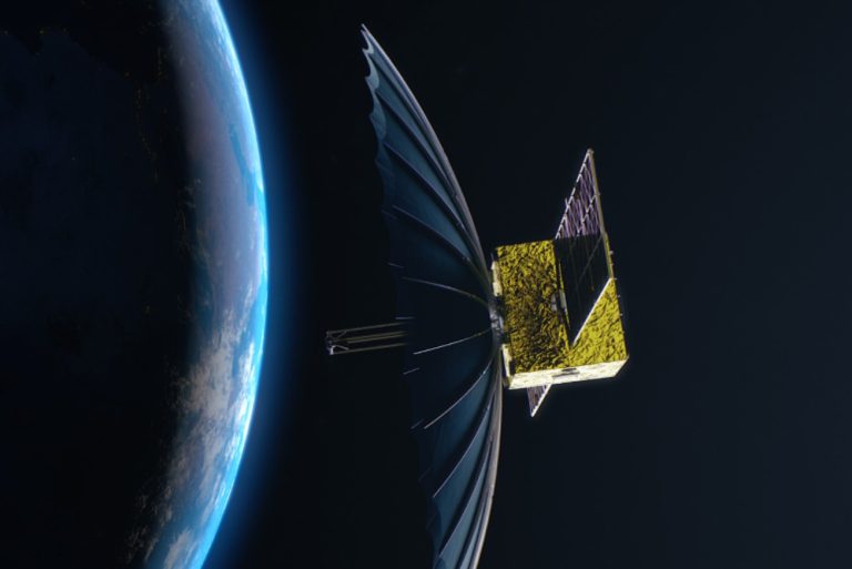
Aetherflux plans to use Apex Space’s Aries satellite bus for its missions. The satellite bus is the core structure of a satellite, providing essential functions like power, propulsion, and communications. Most satellite buses generate power through solar panels, and Aetherflux aims to convert this power into laser energy that can be beamed back to Earth.

The receiving end will consist of ground stations equipped with photovoltaic arrays. These arrays will convert the laser energy into electricity, which can then be stored in batteries for later use. Bhatt and his team, composed of engineers and researchers from organizations like NASA, SpaceX, and Lockheed Martin, are also working on building the first ground station. While a specific location has not been finalized, military sites are being evaluated for their controlled airspace.

Aetherflux Secures $50M Funding to Revolutionize Space Solar Energy in 2026

The Future of Space Solar Energy

Aetherflux’s vision extends beyond just launching a satellite. The company aims to develop small, portable ground stations that can provide electricity to remote locations. This could be a game-changer for communities that lack access to reliable energy sources.

Challenges and Opportunities

While Aetherflux is paving the way for space solar energy, the journey is not without challenges. Few have successfully transmitted solar power from space to Earth. One notable achievement was in 2023, when researchers at Caltech’s Space Solar Power Project demonstrated wireless power transfer from low Earth orbit using microwave beaming. However, Aetherflux aims to create a scalable and commercial system that can meet global energy demands.

Conclusion

Aetherflux is at the forefront of a revolutionary approach to energy production. With significant funding and a clear vision, the startup is poised to change how we think about solar energy. By harnessing the power of the sun from space, Aetherflux could provide a sustainable energy solution for the future.

Facts

    • The idea of space-based solar power was popularized by science fiction writer Isaac Asimov in his 1941 story “Reason.”

    • Baiju Bhatt, before founding Aetherflux, co-founded Robinhood, a company that revolutionized commission-free trading.

    • Aetherflux’s satellite will utilize laser technology to transmit energy, a method that offers precise targeting and minimal atmospheric interference.

References

Starlink Satellites Bring Universal Calling to iPhones and Android Smartphones

Starlink, a division of SpaceX, is redefining mobile communication through its Direct-to-Cell service. This innovation enables voice calls and messaging on regular smartphones, without requiring any specialized hardware or modifications. With a vast satellite network, Starlink promises universal connectivity, even in remote regions, bridging global communication gaps. The service, while still in its early stages, is compatible with most LTE-enabled devices and aims to revolutionize how people stay connected in emergencies and everyday life.

Summary

  • Starlink’s Direct-to-Cell service will allow regular smartphones, both iPhones and Androids, to make calls and send texts via its satellite network.
  • The service does not require specialized hardware—any LTE-enabled device is sufficient.
  • This innovation promises to bring connectivity to remote regions, including oceans, deserts, and rainforests.
  • Successful testing has been conducted with popular smartphone brands like Apple, Samsung, and Google.
  • Even slightly older models, such as the iPhone 13 and iPhone 14, are compatible with the technology.
  • The system supports fully customizable messaging platforms, unlike traditional satellite communication systems.
  • This service could save lives during emergencies, providing reliable communication where traditional networks fail.
  • The technology is being positioned as a solution for travelers, outdoor enthusiasts, emergency responders, and rural areas with limited mobile network coverage.
  • SpaceX is also planning future upgrades, including Internet of Things (IoT) support and satellite-enabled web browsing.
  • Starlink’s innovation addresses the digital divide, offering a lifeline to underserved and rural communities.
  • Commercial packages for the service will be released soon, but pricing details are yet to be announced.
  • Direct-to-Cell could potentially replace cell towers, providing global coverage without infrastructure challenges.
  • The service also has implications for businesses, ensuring uninterrupted operations in remote locations.
  • SpaceX has partnered with major companies to access the PCS G Block spectrum, ensuring reliable performance.
  • Elon Musk’s vision for Starlink represents a significant step in modern communication and universal access.
  • The rollout of this service is expected to reshape the telecommunications industry, offering unprecedented global reach.

Starlink Satellites Bring Universal Calling to iPhones and Android Smartphones

Revolutionizing Connectivity: Starlink’s Direct-to-Cell Service

Starlink, a subdivision of SpaceX, has already disrupted internet accessibility by providing high-speed satellite internet to remote locations. However, the company’s latest innovation, Direct-to-Cell, aims to revolutionize mobile communication by enabling smartphones to connect directly to its satellite network for calls and messaging. This innovation removes the dependency on traditional cell towers and could redefine how we stay connected, especially in challenging terrains or during emergencies.

What sets this apart is its seamless integration with existing smartphones. Users do not need to buy new hardware or make any upgrades. If your phone is LTE-compatible, you’re good to go. For many, this is a game-changer, eliminating the need for bulky satellite phones or unreliable communication options.

How It Works

Starlink’s technology leverages its vast satellite constellation to establish direct connections with smartphones. This is achieved through partnerships with major carriers and spectrum allocation, ensuring compatibility with popular devices like Apple’s iPhones and Samsung’s flagship models.

According to SpaceX, the service has already undergone successful testing, proving its capability to connect urban, rural, and even challenging environments like forests or open seas.

Compatibility Across Devices

Starlink’s Direct-to-Cell service is designed with universality in mind. Unlike other satellite communication solutions, this service does not restrict users to specific models or brands. Whether you own an iPhone 14, a Samsung Galaxy S22, or a Google Pixel, your phone can leverage this cutting-edge connectivity. The service ensures compatibility across all LTE-enabled smartphones, making it accessible to a vast global audience.

Older devices aren’t left behind either. SpaceX confirmed that slightly older models, like the iPhone 13, work seamlessly with the network, ensuring widespread adoption without forcing users to upgrade their phones.

Applications Beyond Convenience

While the convenience of universal connectivity is appealing, the true impact of Starlink’s service lies in its life-saving potential. The system is designed to provide reliable communication in emergency situations, where traditional networks often fail. From natural disasters to outdoor expeditions, this technology ensures that users can stay connected, relay crucial information, and receive help when needed.

Unlike traditional satellite communication systems that restrict users to pre-set text options, Starlink allows for fully customizable messages. This flexibility can make a critical difference in emergencies, enabling users to send detailed information about their location or situation.

Future Implications

Starlink is not stopping at calls and texts. According to a letter sent by SpaceX to the Federal Communications Commission (FCC), the company plans to expand its services to include IoT connectivity, voice communication, and web browsing through its satellite network. These developments could open up new opportunities for industries ranging from logistics to healthcare.

Table 1: Current and Future Applications of Starlink Direct-to-Cell

Current Applications Future Applications
Voice Calls Internet of Things (IoT)
Text Messaging Satellite-enabled Web Browsing
Emergency Communication Advanced Voice Communication
Remote Location Connectivity Business Operations Support

One of the most significant challenges in global communication is the digital divide—the gap between those with access to reliable connectivity and those without. Despite advances in mobile networks, vast regions remain underserved, especially in developing countries. Starlink’s Direct-to-Cell service could offer a lifeline to these areas, providing affordable, reliable communication options.

For rural communities, where building cell towers is often impractical or too expensive, satellite connectivity offers a practical solution. Similarly, for travelers and outdoor enthusiasts venturing into uncharted territories, Starlink ensures that they are never out of reach.

Impact on Telecommunications

The rollout of Starlink’s Direct-to-Cell service is expected to disrupt the telecommunications industry significantly. By bypassing traditional infrastructure, such as cell towers, this innovation could reduce the dependency on regional networks, leveling the playing field for users in remote locations.

Table 2: Comparison of Traditional Networks vs. Starlink’s Direct-to-Cell

Feature Traditional Networks Starlink Direct-to-Cell
Dependency on Cell Towers High None
Coverage in Remote Areas Limited Universal
Hardware Requirements New Models Often Required LTE-Compatible Devices Only
Emergency Accessibility Often Unreliable Highly Reliable

Challenges and Considerations

While the technology is promising, there are challenges to address. Cost is a significant factor, as satellite communication has traditionally been more expensive than traditional mobile networks. SpaceX has not yet revealed the pricing details for this service, but ensuring affordability will be crucial for widespread adoption.

Regulatory hurdles also need to be overcome. Operating a global satellite network requires approval from multiple governing bodies, and managing spectrum allocation can be complex.

Facts

  • The Starlink constellation currently consists of over 4,500 satellites, with plans for more launches.
  • SpaceX’s ambitious goal includes providing global internet access and now mobile connectivity.
  • Elon Musk envisions Starlink as a key enabler for Mars colonization, serving as the backbone of interplanetary communication.

Starlink’s Direct-to-Cell service represents a monumental leap in mobile communication. By leveraging its satellite network, SpaceX is making universal connectivity a reality, ensuring that no one is left behind, whether in urban centers or the most remote corners of the Earth. With the promise of future innovations and expansions, this technology is poised to reshape how the world communicates.

References

  1. Starlink Official Website
  2. FCC Public Filings on SpaceX Direct-to-Cell Service
  3. SpaceX Technology News
  4. Global Mobile Connectivity
  5. Digital Divide Statistics

India’s Satellite Constellation Plan Attracts 30 Companies: A New Era of Space Ambitions

India’s move to establish indigenous Earth observation (EO) satellite constellations represents a monumental shift towards self-reliance in space data, reducing dependence on foreign sources while enabling national security and infrastructure advancements.

Summary

  • The Indian National Space Promotion and Authorisation Centre (IN-SPACe) has received nine consortium applications involving 30 companies for India’s satellite constellation project.
  • Objective: Strengthen India’s data sovereignty and reduce reliance on foreign EO satellite data for defense, climate monitoring, and infrastructure development.
  • Market projections estimate the small satellite and data services industry to reach $45 billion globally by 2030.
  • Prominent applicants include Pixxel, a Google-backed startup, and SatSure, supported by Baring Private Equity. Established corporations like Tata Advanced Systems are also involved.
  • Criteria for qualification include raising a minimum investment of Rs 850 million ($10 million) and establishing spacecraft control centers in India.
  • The Indian government offers loans up to Rs 3.5 billion ($42 million) to the selected consortium.
  • Technical evaluations of the applications will conclude by January 2025, leading to a tender process for final selection.
  • This initiative is part of India’s broader space strategy, which also includes a Rs 10 billion venture fund for startups.
  • Success in this endeavor could transform India’s space sector, fostering innovation, economic growth, and data independence.
India's Satellite Constellation Plan Attracts 30 Companies A New Era of Space Ambitions
The people evaluating the applications plan to finish by the end of January 2025. They will complete technical evaluations. This means they will closely examine the technical details of the applications.

India’s Vision: A Bold Leap in Space Exploration

India has steadily emerged as a formidable player in space technology, and this recent initiative underscores the nation’s aspirations to lead the space economy. The Earth Observation (EO) satellite constellations are poised to address critical national needs, from defense to infrastructure planning, while propelling India into the global commercial space arena.

The Indian government’s call for private sector collaboration follows the recent liberalization of the space sector, which opened doors for commercial participation. This marks a significant departure from a previously state-centric model dominated by the Indian Space Research Organisation (ISRO).

“India’s space ecosystem is set to bloom, blending public and private innovation,” said Pawan Goenka, chairman of IN-SPACe.

Market Potential: A Thriving Industry Awaits

The market for small satellites and EO data services is projected to reach $45 billion by 2030. This growth is fueled by the increasing need for high-resolution imagery and real-time analytics in various domains:

Sector Use of EO Data
Defense and Security Surveillance, border monitoring
Infrastructure and Urban Planning Smart city planning, disaster management
Telecommunications Network optimization
Agriculture Crop monitoring, yield forecasting
Climate and Environment Weather prediction, climate change tracking

Private Players: Driving Innovation

The initiative has drawn in many different participants. These participants include startups, which are newly established businesses. Established corporations, which are large companies with a long history, are also joining.

Company Key Strength
Pixxel Expertise in hyperspectral imaging technology
SatSure Specializes in data analytics for agriculture
Tata Advanced Systems Proven track record in defense technology

Government’s Role: Empowering the Ecosystem

Recognizing the high costs associated with satellite projects, the Indian government has taken steps to mitigate financial barriers for private companies. Key measures include:

  • Loans up to Rs 3.5 billion ($42 million) for selected bidders.
  • A Rs 10 billion venture fund to encourage space startups.
  • Support for the establishment of spacecraft control centers within India.

These initiatives aim to ensure that private players have the necessary infrastructure and financial backing to succeed.

Why EO Data Matters

Earth Observation (EO) data serves as the backbone for numerous critical applications:

  • Defense: Monitoring troop movements and securing borders.
  • Disaster Management: Predicting natural disasters and enabling swift response.
  • Agriculture: Assessing crop health and planning irrigation.
  • Urban Development: Supporting smart city initiatives and sustainable planning.

India’s current dependence on foreign EO data, particularly from organizations like the European Space Agency, underscores the urgency of developing indigenous capabilities.

Challenges Ahead

Despite the optimism surrounding the initiative, several challenges must be addressed:

  • Regulatory Hurdles: Ensuring a streamlined process for approvals and compliance.
  • Funding Gaps: Bridging the gap between government loans and total project costs.
  • Technological Complexity: Developing cutting-edge satellites to compete globally.
  • Global Competition: Staying ahead in an increasingly crowded space market.

The Road to 2030

As India aims to complete technical evaluations by January 2025, the timeline for the satellite constellation project is ambitious but achievable. Once implemented, the constellation will transform not only India’s space sector but also its broader economy.

Facts About India’s Space Ambitions

  • India launched its first satellite, Aryabhata, in 1975.
  • The Mars Orbiter Mission (MOM) was completed on a shoestring budget of just $74 million, making it one of the most cost-effective missions ever.
  • India’s Chandrayaan-3 became the first mission to successfully land near the Moon’s south pole.

References

  1. SatSure
  2. Tata Advanced Systems
#IndiaSpaceMission, #EarthObservation, #SatelliteConstellation, #INSPACe, #ISRO, #SpaceStartups, #Pixxel, #SatSure, #TataAdvancedSystems, #SpaceEconomy, #IndiaEOData, #MarsOrbiterMission, #SatelliteTechnology, #SpaceInnovation, #ClimateMonitoring

Poland Secures Four Observation Satellites: A Leap in Space Defense

Poland’s decision to acquire four advanced observation satellites marks a significant stride in bolstering its national security, technological sovereignty, and space defense capabilities. This investment symbolizes Poland’s commitment to leveraging cutting-edge technology to protect its interests amidst rising regional tensions.

Summary

  • Poland signed a $134 million contract with Creotech Instruments to build and deploy four advanced microsatellites by 2027.
  • These satellites will operate in sun-synchronous orbits, providing imaging capabilities in visible and near-infrared light bands.
  • Creotech’s HyperSat platform forms the foundation of this ambitious project, reinforcing Poland’s technological independence.
  • In June 2024, Poland started a new agency. This agency is called the Geospatial Reconnaissance and Satellite Services Agency. It is very important for managing satellites.
  • Poland plans to integrate foreign and domestic technologies into its defense strategy to address escalating regional challenges.
  • Earlier agreements with Airbus and other stakeholders demonstrate Poland’s ongoing commitment to advancing its space capabilities.

The Historical Context of Poland’s Space Ambitions

Poland’s journey in space exploration and defense has evolved significantly in recent years. Historically, the country has relied on international partnerships and foreign technologies for its space initiatives. However, escalating geopolitical challenges and the need for greater self-reliance have prompted Poland to enhance its national capabilities.

The establishment of the Geospatial Reconnaissance and Satellite Services Agency in June 2024 serves as a cornerstone for these efforts. This agency is tasked with managing satellite systems and integrating space-based data into Poland’s armed forces operations.

Creotech Instruments, a Polish firm specializing in space technology, represents a beacon of this transition toward self-sufficiency. Its selection to develop four satellites underlines Poland’s intention to prioritize domestic innovation while maintaining strategic collaborations with international entities like Airbus.

Poland’s Strategic Investment in Space Defense

Poland’s recent move to bolster its space defense is not merely about technological advancement. It reflects a carefully calculated strategy to ensure national security and safeguard against evolving regional threats.

The four satellites, scheduled for deployment by 2027, will enhance Poland’s ability to monitor critical infrastructure, manage natural disasters, and strengthen military operations. These satellites will:

  • Operate in sun-synchronous orbits, ensuring consistent imaging quality.
  • Provide high-resolution imaging across visible and near-infrared spectra.
  • Support military reconnaissance and civilian disaster response initiatives.

Key Focus Areas of Investment

Focus Area Description
Technological Sovereignty Developing and deploying satellites built on domestic platforms like HyperSat.
Regional Security Enhancing surveillance to address growing geopolitical tensions in Eastern Europe.
International Collaboration Partnering with companies like Airbus while prioritizing domestic innovation.

This dual approach underscores Poland’s strategy to combine foreign expertise with local innovation, creating a robust and adaptable space defense infrastructure.

Creotech Instruments: The Backbone of Poland’s Space Ambitions

Creotech Instruments, Poland’s leading space technology company, has been pivotal in the country’s quest for technological self-reliance. The HyperSat platform, developed by Creotech, is a modular and versatile satellite platform designed to accommodate various payloads.

Capabilities of the HyperSat Platform

Feature Details
Scalability Flexible design supports small to medium satellite payloads.
Optical Precision Advanced optical instruments for near-infrared and visible imaging.
Compatibility Seamless integration with existing ground station infrastructure.
Launch Readiness Designed for compatibility with multiple launch vehicles.

Creotech’s leadership in this project highlights Poland’s ability to develop cutting-edge space technologies while contributing to its national defense framework.Jakub Bochinski, Deputy Director of Space Products, Creotech Instruments

The Role of Geospatial Reconnaissance

The newly established Geospatial Reconnaissance and Satellite Services Agency plays a crucial role in integrating satellite data into Poland’s defense strategy. This agency not only oversees the management of satellite systems but also ensures that the Polish Armed Forces can effectively utilize satellite imagery for reconnaissance and planning.

Some of the key responsibilities of this agency include:

By focusing on these areas, the agency strengthens Poland’s ability to maintain operational readiness in the face of dynamic geopolitical challenges.

A Broader Context: Global Trends in Space Defense

Poland’s focus on space defense aligns with a broader global trend. Nations across the world are increasingly leveraging space technologies to enhance their defense capabilities. For instance:

  • The United States leads in military space operations, with agencies like the Space Force overseeing extensive satellite networks.
  • China and Russia have prioritized the development of space-based assets to support reconnaissance, communication, and navigation.
  • European nations, including Poland, are collaborating through organizations like the European Space Agency to advance space technologies.

Poland’s decision to develop a national satellite system reflects its desire to remain competitive in this rapidly evolving domain.

The Future of Poland’s Space Program

Poland’s ambitions extend beyond the deployment of these four satellites. The government has outlined plans to establish a comprehensive space infrastructure that includes:

Enhancing Regional Cooperation

Poland also aims to strengthen regional cooperation by sharing satellite data with neighboring countries. This collaborative approach could foster greater stability and security in Eastern Europe, addressing shared challenges such as:

  • Border monitoring.
  • Disaster response coordination.
  • Countering potential cyber threats to space assets.

Fun Facts

  • The term “sun-synchronous orbit” means the satellite passes over the same point on Earth at the same local solar time every day.
  • Poland’s investment in space defense represents the largest satellite procurement ever awarded to a domestic company.
  • Creotech’s HyperSat platform is designed to be highly modular, allowing for a wide range of applications beyond defense.

References

  1. Creotech Instruments Official Website
  2. European Space Agency Initiatives
  3. Sun-Synchronous Orbit Definition
#PolandSpaceDefense, #SatelliteTechnology, #GeospatialReconnaissance, #HyperSat, #SpaceInnovation, #NationalSecurity, #DefenseTechnology, #PolandSatellites, #SpaceExploration, #CreotechInstruments, #MilitaryObservation, #SatelliteProcurement, #SunSynchronousOrbit, #RegionalSecurity, #SpaceDefense

Sentinel-1C Satellite Successfully Launches Into Space: Advancing Earth Observation

The successful launch of Sentinel-1C on a VEGA-C rocket marks a significant advancement in Earth observation, enhancing our capacity to monitor climate change, respond to natural disasters, and manage land and sea resources. This satellite, part of the European Copernicus program, ensures continuous, high-quality data collection using cutting-edge radar technology, strengthening global environmental monitoring strategies.

Summary

  • Sentinel-1C launched successfully on a VEGA-C rocket and will orbit 700 km above the Earth.
  • Part of the European Copernicus programme, it employs advanced radar technology for all-weather, day-and-night imaging of Earth’s surface.
  • The satellite complements Sentinel-1A, forming a synchronized constellation for enhanced Earth observation capabilities.
  • Sentinel-1C supports critical applications like sea-ice monitoring, forest management, disaster response, and climate tracking.
  • The UK had a crucial role in creating essential parts. These parts included radar subsystems and batteries. Radar subsystems are parts of a system that helps detect objects using radio waves. Batteries are devices that store and provide electrical energy to power various equipment.
  • Airbus Defence and Space UK led the design and manufacture of radar electronic subsystems.
  • Sentinel-1C carries an Automatic Identification System (AIS) for ship collision avoidance and maritime surveillance.
  • This satellite bolsters long-term data collection for operational services rather than research purposes, ensuring reliable information for monitoring environmental changes.
  • Sentinel-1C data is crucial for governments, industries, and academics, offering actionable insights across diverse applications.
  • Copernicus satellites, including Sentinel-2C launched earlier, enable Europe and the UK to maintain leadership in global environmental monitoring.

Mission Overview and Launch Details

Sentinel-1C launched on the VEGA-C rocket. The launch took place at Europe’s Spaceport in French Guiana. Sentinel-1C reached an orbit 700 km above Earth. Its mission is to continue the Sentinel-1 mission. This mission started with Sentinel-1A, which launched in 2014. Both satellites will work together. They will provide continuous and complete Earth observation data.

The satellite is equipped with a Synthetic Aperture Radar (SAR), a highly advanced technology capable of capturing images of the Earth’s surface regardless of weather conditions or time of day. SAR’s versatility makes it invaluable for monitoring Arctic ice, detecting land movements, and assessing disaster impacts.

For further details about the Sentinel-1 mission, visit Sentinel Copernicus.

Role of the UK in Sentinel-1C Development

The UK played an important role in developing Sentinel-1C. Airbus Defence and Space in Portsmouth provided the electronics subsystem for the SAR instrument, while Enersys ABSL in Abingdon supplied the satellite’s battery.

Justin Byrne, Head of Earth Observation at Airbus UK, emphasized, “The UK has designed and manufactured radar electronics for the entire Sentinel-1 family, ensuring critical European satellite missions remain operational.”

The satellite exemplifies the UK’s commitment to Earth observation and innovation, supported by funding from the UK Space Agency. The nation’s contributions bolster the global impact of the Copernicus program and enhance its ability to deliver consistent, actionable data.

Sentinel-1C Satellite Successfully Launches Into Space Advancing Earth Observation

Applications and Benefits of Sentinel-1C

Sentinel-1C’s high-resolution radar data serves a broad range of applications, including:

Application Impact
Climate Change Monitoring Tracks sea ice extent, glacier motion, and other climate variables to assess global warming.
Disaster Response Provides real-time data for responding to floods, earthquakes, and volcanic eruptions.
Maritime Surveillance Tracks shipping routes, detects piracy, and enhances global maritime safety.
Agriculture and Forestry Monitors soil health, forest cover, and water resources to support sustainable practices.

The satellite’s Automatic Identification System (AIS) adds a new dimension to maritime safety by tracking vessels and detecting illegal activities like unregulated fishing and piracy. Learn more about Earth observation benefits at Innovation News Network.

Long-Term Data Collection for Climate Change

Unlike research satellites, Sentinel-1C is designed for operational service, ensuring consistent and reliable data for decades. Its capabilities are critical for addressing some of the world’s most pressing issues:

  • Land Motion Monitoring: Detects subtle ground movements in urban areas, enabling preventive measures against infrastructure failures.
  • Sea Ice and Oceanography: Tracks changes in Arctic and Antarctic ice, crucial for understanding the impacts of global warming.
  • Disaster Preparedness: Improves early warning systems for earthquakes and floods, saving lives and minimizing economic losses.

Dr. Chandra Taposeea-Fisher, Chair of the EO Committee at UKspace, explained, “Sentinel-1C’s data will empower communities and governments to make informed decisions about environmental conservation and disaster reduction.”

Technological Innovations

The SAR technology aboard Sentinel-1C is complemented by the newly integrated Automatic Identification System (AIS). This combination enables comprehensive monitoring of global maritime activities, from enhancing shipping efficiency to detecting environmental hazards like oil spills.

Professor Remedios emphasized the significance of operational radar satellites:
“The advent of radar satellites has revolutionized our ability to observe hazardous and extreme environments.”

This innovation aligns with the Copernicus programme’s mission to provide free, accessible data to scientists, governments, and industries worldwide.

Facts

  • Sentinel-1C can capture radar images through clouds and at night, unlike optical satellites.
  • The radar operates at C-band frequencies, enabling detailed surface mapping.
  • The satellite’s data archive will contribute to machine learning algorithms, further enhancing Earth observation research.

References

  1. How Earth Observation Satellite Data Is Used to Benefit Society
  2. Sentinel Copernicus: Sentinel-1
#Sentinel1C, #CopernicusProgramme, #EarthObservation, #ClimateChange, #MaritimeSafety, #SatelliteTechnology, #SARImaging, #GlobalMonitoring, #DisasterResponse, #UKSpaceIndustry, #Innovation, #EarthScience, #SpaceExploration, #RadarTechnology, #ClimateTracking

MuxIP and Eutelsat Bring Global Sports Channels to EMEN

Eutelsat Group and MuxIP have announced an innovative partnership to launch a selection of global sports channels via Eutelsat’s HOTBIRD satellites, targeting audiences across Europe, the Middle East, and North Africa (EMENA). This initiative leverages the extensive reach of satellite technology and the growing popularity of Free Advertising Supported TV (FAST) platforms. The channels, which include World Poker Tour, Cricket Gold, and Outdoor Channel, will be free-to-air and customized for EMENA audiences. This collaboration represents a significant step in expanding access to diverse sports content in the region.

Summary

  • Partnership Overview: Eutelsat Group and MuxIP collaborate to launch global sports channels in EMENA via satellite.
  • Satellite Technology: The channels will be distributed using Eutelsat’s HOTBIRD satellites at 13° East.
  • Channels Included: Initial channels include World Poker Tour, Cricket Gold, and Outdoor Channel.
  • FAST Platforms: Channels are part of the Free Advertising Supported TV (FAST) platforms.
  • Target Regions: The channels will be available in Europe, the Middle East, and North Africa.
  • Customization: Versions of the channels will be tailored for the EMENA audience.
  • Ad-Supported: Channels will be free-to-air, supported by advertising.
  • Broad Distribution: The initiative expands the distribution of sports content beyond terrestrial networks.
  • Leadership Commentary: Eutelsat and MuxIP leaders express optimism about the collaboration.
  • Audience Reach: The partnership aims to reach new audiences with diverse sports content.
  • Advertiser Benefit: The combination of satellite and FAST platforms is expected to be beneficial for advertisers.
  • Global Presence: Channels have a strong presence in the US, Canada, Australia, India, and now EMENA.
  • Market Impact: The initiative could reshape the sports broadcasting landscape in the EMENA region.
  • Future Prospects: Potential expansion to include more channels and regions in the future.
  • Technological Innovation: The collaboration highlights the integration of satellite and streaming technologies.

MuxIP and Eutelsat Bring Global Sports Channels to EMEN

The Launch of EMENA Sports Channels via Eutelsat and MuxIP

The Eutelsat Group, in collaboration with MuxIP, has embarked on a groundbreaking initiative to bring a selection of global sports channels to audiences across Europe, the Middle East, and North Africa (EMENA). This partnership represents a significant advancement in the distribution of sports content, leveraging both satellite technology and the rapidly growing Free Advertising Supported TV (FAST) platforms. This article explores the details of this collaboration, the channels involved, the technology behind it, and its potential impact on the EMENA region.

The Partnership: Eutelsat and MuxIP

Eutelsat, a leading satellite operator, has a long history of providing reliable satellite services across various regions. MuxIP, on the other hand, is a pioneer in next-generation media SaaS technologies, particularly in the realm of ad-supported streaming. Together, they have formed a partnership that combines the strengths of both companies to distribute sports channels via satellite in the EMENA region.

Laurence Delpy, President of Eutelsat’s Video Business Unit, emphasized the significance of this collaboration, stating, “We are delighted to collaborate with MuxIP on this innovative initiative. Thanks to the extensive reach of satellite, we are able to increase the distribution of these sports TV channels from around the world, bringing them free-to-air to new audiences beyond terrestrial networks, supported by advertising aligned with the FAST Industry.”

The distribution of these sports channels will be facilitated by Eutelsat’s flagship HOTBIRD satellites positioned at 13° East. These satellites are renowned for their wide coverage area, making them an ideal choice for reaching diverse audiences across the EMENA region. The use of satellite technology ensures that the channels can be broadcasted free-to-air, allowing viewers to access the content without the need for a subscription.

Table 1: Key Features of Eutelsat HOTBIRD Satellites

Feature Description
Position 13° East
Coverage Area Europe, the Middle East, North Africa
Broadcast Type Free-to-air
Supported Platforms FAST (Free Advertising Supported TV)
Primary Channels World Poker Tour, Cricket Gold, Outdoor Channel

The Channels

The initial set of channels being distributed under this partnership includes World Poker Tour, Cricket Gold, and Outdoor Channel. Each of these channels offers unique sports content that caters to a wide range of audiences.

  • World Poker Tour: This channel is dedicated to broadcasting internationally televised poker events. It features exclusive content and expert analysis, making it a go-to destination for poker enthusiasts.
  • Cricket Gold: Cricket Gold offers a nostalgic journey through 40 years of classic cricket action. The channel showcases memorable matches, legendary players, and iconic moments from the world of cricket.
  • Outdoor Channel: Focused on outdoor lifestyles and personalities, the Outdoor Channel brings viewers closer to nature. It features content related to hunting, fishing, and adventure sports, appealing to those who love the great outdoors.

These channels have already established a strong presence on FAST platforms in countries such as the US, Canada, Australia, and India. The partnership with Eutelsat and MuxIP will now extend their reach to audiences in the UK, continental Europe, the Middle East, and North Africa.

FAST platforms have revolutionized the way content is delivered to audiences. Unlike traditional TV channels that require a subscription, FAST channels are free-to-air and supported by advertising. This model has gained significant traction in recent years, especially as viewers seek more flexible and affordable ways to access content.

The integration of FAST platforms with satellite technology is a key aspect of this partnership. By combining the extensive reach of satellite with the growing popularity of FAST channels, Eutelsat and MuxIP are creating a powerful distribution network that benefits both audiences and advertisers.

Frank Brown, MD International at MuxIP, highlighted the potential of this collaboration, stating, “For these channels, the integration of the exploding FAST industry together with the expansive reach of satellite is an extremely powerful combination. The relevant audiences and advertisers will all benefit enormously from the launch of these unique TV channels in the EMENA regions.”

The launch of these sports channels via satellite is expected to have a profound impact on the EMENA region. For many viewers, this initiative will provide access to high-quality sports content that was previously unavailable or limited to subscription-based services. The free-to-air model ensures that a broader audience can enjoy these channels, regardless of their financial situation.

Moreover, the customization of the channels for European audiences means that the content will be more relevant and engaging for viewers in the EMENA region. This localized approach is crucial for ensuring that the channels resonate with their target audience.

Table 2: Potential Benefits of the Eutelsat and MuxIP Partnership

Benefit Description
Expanded Access Free-to-air channels increase accessibility for a broader audience
Customized Content Channels tailored for European audiences
Ad-Supported Model Revenue generation through advertising
Technological Integration Combines satellite reach with FAST platform flexibility
Diverse Content Offers a variety of sports programming, including poker, cricket, and outdoor activities

Advertiser Benefits and Market Potential

The combination of satellite distribution and FAST platforms presents a unique opportunity for advertisers. With the ability to reach millions of viewers across the EMENA region, advertisers can effectively target specific demographics with relevant ads. The free-to-air nature of the channels also means that they are likely to attract a larger audience, increasing the potential reach of advertising campaigns.

This partnership could also reshape the sports broadcasting landscape in the EMENA region. As more viewers turn to free-to-air channels, there may be a shift away from traditional subscription-based services. This trend could lead to increased competition in the market, prompting other broadcasters to explore similar models.

The launch of these initial channels is just the beginning. The partnership between Eutelsat and MuxIP has the potential to expand further, with the addition of more channels and the possibility of reaching other regions. As the demand for diverse and accessible sports content continues to grow, this collaboration could pave the way for new opportunities in the broadcasting industry.

In the future, we may see the inclusion of additional sports channels that cater to different interests and demographics. This expansion could also include more localized content, ensuring that the channels remain relevant and engaging for audiences in the EMENA region.

#Eutelsat, #MuxIP, #EMENASports, #SatelliteBroadcasting, #FASTChannels, #FreeToAirTV, #WorldPokerTour, #CricketGold, #OutdoorChannel, #SatelliteTechnology, #SportsContent, #EMENARegion, #AdvertiserBenefit, #BroadcastingInnovation, #GlobalSports

Arab Satellite 813: Final Design Review by NSSTC at UAE University

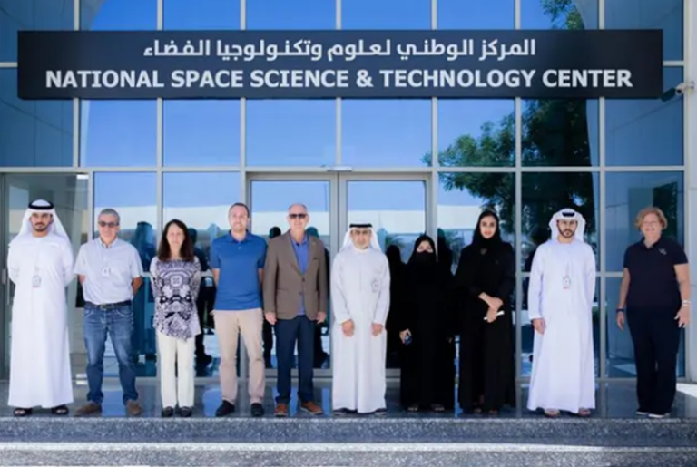
  • The National Space Science and Technology Centre (NSSTC) at UAE University has completed the final design review for Arab Satellite 813.
  • This satellite will provide hyperspectral observations in the Visible/Near Infrared (VNIR) and Shortwave Infrared (SWIR) regions.
  • Funded by the UAE Space Agency (UAESA), the project aims to enhance collaboration among Arab Space Cooperation Group (ASCG) countries.
  • The design review sessions evaluated the satellite’s design, sensors, and ground support systems.
  • The next phase is Assembly Integration and Test (AI&T) at NSSTC.
  • The satellite is named 813 to commemorate the House of Wisdom in Baghdad under Al-Ma’mun.
  • Emphasis on local manufacturing aims to boost regional expertise in satellite technology.

Summary

  • NSSTC at UAE University completed the design review for Arab Satellite 813.
  • The satellite will provide hyperspectral observations in the VNIR and SWIR regions.
  • The project is funded by UAESA and executed by UAE University.
  • The design review sessions evaluated the satellite’s design, sensors, and ground support systems.
  • The next phase is AI&T at NSSTC.
  • The satellite is named 813 to honor the House of Wisdom.
  • Emphasis on local manufacturing to enhance regional expertise.
  • Arab Satellite 813 will monitor Earth’s environment and climate.
  • It focuses on the UAE and ASCG member countries.
  • The satellite features advanced sensors and ground support systems.


View this post on Instagram


A post shared by NSSTC (@nsstc.uae)

Exclusive insights from #GWF2024! Hear from NSSTC’s team and forum organizers about the future of geospatial technology and space exploration.

Arab Satellite 813: Final Design Review by NSSTC at UAE University

The National Space Science and Technology Centre (NSSTC) at UAE University recently held a series of sessions to finalize the design of the Arab Satellite 813. This advanced earth observation satellite, funded by the UAE Space Agency (UAESA) and executed by UAE University, is a significant project aimed at enhancing collaboration among Arab Space Cooperation Group (ASCG) countries in space science and technology.

During the review sessions, experts conducted a thorough evaluation of the satellite’s design, its payload of various sensors, and the design of the ground support systems. These evaluations are crucial to ensuring the satellite meets all operational requirements and can successfully perform its intended mission.

Arab Satellite 813 is equipped to provide hyperspectral observations in the Visible/Near Infrared (VNIR) and Shortwave Infrared (SWIR) regions of the electromagnetic spectrum. These observations are vital for monitoring Earth’s environment and climate, focusing on the UAE and other member countries of the ASCG.

Following the successful completion of the design phase, the engineering teams are set to advance to the Assembly Integration and Test (AI&T) phase at the NSSTC. Salem Butti Salem Al Qubaisi, Director General of the UAE Space Agency, highlighted the importance of this phase in ensuring the satellite’s components work seamlessly together.

The satellite is named 813 to commemorate the inception of the House of Wisdom in Baghdad under Al-Ma’mun’s reign. This institution was known for its significant contributions to science and scholarship, symbolizing the satellite’s role in advancing scientific knowledge and collaboration among Arab nations.

Key Features

Arab Satellite 813 is distinguished by its weight, size, and efficiency compared to other hyperspectral satellites. The design and selection process emphasized local manufacturing capabilities, aiming to enhance domestic and regional expertise in satellite design, production, assembly, testing, and data analysis.

Table 1: Key Specifications of Arab Satellite 813

Feature Specification
Weight 150 kg
Size 1.5 x 1 x 1 m
Spectral Range VNIR and SWIR
Payload Hyperspectral Optical Instrument

Collaborative Efforts

This mission will help ASCG member countries work together. The satellite will give important data for tracking the environment and climate. Working on this project together shows how regional partnerships are key to growing space science and technology.

Quotes from Officials

Salem Butti Salem Al Qubaisi, Director General of the UAE Space Agency, stated:

“The successful completion of the design review marks a significant milestone in our mission to enhance regional cooperation in space science and technology. Arab Satellite 813 will provide invaluable data to monitor and understand our environment and climate.”

The design review sessions also included a comprehensive evaluation of the ground support systems. These systems are essential for the satellite’s operation, ensuring that it can communicate effectively with ground stations and that the data collected can be processed and analyzed accurately.

The development of Arab Satellite 813 is a significant step forward for the UAE and the ASCG. By focusing on local manufacturing and regional collaboration, the project aims to build a robust foundation for future space missions, leveraging advanced technology and expertise to address environmental and climate challenges.

Table 2: Milestones in Arab Satellite 813 Development

Milestone Date
Project Initiation January 2020
Design Review Completion July 2024
Assembly Integration and Test August 2024
Launch Scheduled 2025

Conclusion

The final design review of Arab Satellite 813 marks a pivotal moment in the project’s development. With its advanced hyperspectral capabilities, the satellite is set to provide critical data for environmental and climate monitoring, fostering regional collaboration and enhancing local expertise in satellite technology.

Hashtags

#ArabSatellite813, #NSSTC, #UAEUniversity, #UAESpaceAgency, #ASCG, #HyperspectralObservations, #EnvironmentalMonitoring, #ClimateMonitoring, #SatelliteTechnology, #SpaceScience, #RegionalCollaboration

First All-Electric Propulsion Communication Satellite by China Becomes Fully Operational After In-Orbit Testing

Key Takeaway

China’s first all-electric propulsion communication satellite, APStar-6E, has become fully operational after successful in-orbit testing. This satellite aims to provide high-capacity, cost-effective broadband communication services to Southeast Asia, enhancing the region’s information industry and addressing the digital divide.

Summary

  • Satellite Name: APStar-6E
  • Launch Date: January 13, 2023
  • Launch Vehicle: Long March-2C carrier rocket
  • Launch Site: Xichang Satellite Launch Center, Sichuan Province, China
  • Satellite Platform: DFH-3E
  • Manufacturer: China Great Wall Industry Corporation (CGWIC)
  • Operator: APT Mobile Satcom Limited
  • Management: APT Satellite Company Limited
  • Operational Slot: 134°E
  • Communication Capacity: 30 Gbps
  • Lifespan: 15 years
  • Bands: 25 Ku-band user beams, 3 Ka-band gateway beams
  • Significance: Enhances international competitiveness of China’s communication satellite platforms, supports autonomous orbit transfer, and improves intelligent autonomy of satellite platforms
  • Global Impact: Provides high-throughput broadband resources to developing areas, helping bridge the digital divide
  • International Programs: CGWIC has conducted 13 in-orbit delivery communication satellite programs for international customers including Nigeria, Venezuela, Pakistan, Bolivia, Laos, Belarus, and Algeria
First All-Electric Propulsion Communication Satellite by China Becomes Fully Operational After In-Orbit Testing
APStar-6E

Main Article

The Asia-Pacific-6E, also known as APStar-6E, is a milestone in China’s space technology, representing the country’s first all-electric propulsion communication satellite. Developed by the China Academy of Spacecraft Technology using the DFH-3E satellite platform, the APStar-6E has successfully passed all in-orbit technology verification and ground station technology reviews, making it fully operational.

Development and Launch

The APStar-6E was developed by the China Academy of Spacecraft Technology using the DFH-3E satellite platform. It was launched on January 13, 2023, aboard a Long March-2C carrier rocket from the Xichang Satellite Launch Center in Sichuan Province, China. This launch marked a significant achievement as it featured the first use of dual electric propulsion systems for station-keeping and autonomous orbit transfer.

Table 1: APStar-6E Key Specifications

Specification Details
Satellite Name APStar-6E
Launch Date January 13, 2023
Launch Vehicle Long March-2C carrier rocket
Launch Site Xichang Satellite Launch Center
Satellite Platform DFH-3E
Communication Capacity 30 Gbps
Lifespan 15 years
Bands 25 Ku-band user beams, 3 Ka-band gateway beams

In-Orbit Testing and Verification

After the launch, the APStar-6E separated from its propulsion module on January 23, 2023. It then utilized its onboard Hall/Ion dual electric propulsion systems to autonomously change orbits. By June 10, 2024, the satellite had reached its geosynchronous orbit (GEO) and was positioned at its test location.

The in-orbit testing of the APStar-6E proceeded smoothly, with the satellite completing the first phase of testing on July 9, 2024. It was subsequently repositioned to its operational slot at 134°E, co-located with the APStar-6C and APStar-6D satellites. According to the China Great Wall Industry Corporation (CGWIC), the payload of the APStar-6E is functioning normally, with performance meeting contractual specifications and in-orbit operational requirements.

Operational Significance

The successful operation of the APStar-6E is significant for several reasons:

  • High-Capacity and Low-Cost Satellite Platforms: The APStar-6E represents a new generation of high-capacity, cost-effective satellite platforms. Its ability to provide approximately 30 Gbps of communication capacity makes it a valuable asset for broadband communication services.
  • Autonomous Orbit Transfer: The APStar-6E is the first Chinese satellite to achieve autonomous orbit transfer using its dual electric propulsion systems. This capability enhances the satellite’s operational flexibility and reduces dependency on traditional chemical propulsion systems.
  • Intelligent Autonomy: The satellite’s successful in-orbit operations demonstrate improvements in the intelligent autonomy of China’s satellite platforms. This advancement allows for more efficient management and operation of satellite systems.

Table 2: APStar-6E Communication Capabilities

Communication Band Number of Beams Capacity
Ku-band 25 user beams High-capacity
Ka-band 3 gateway beams High-throughput

Impact on Southeast Asia

The APStar-6E focuses on providing high-capacity, cost-effective broadband communication services to the Southeast Asian market. This region has a significant digital divide, with many areas lacking reliable internet connectivity. The APStar-6E aims to address this issue by offering high-throughput broadband satellite resources, which will aid the development of the regional information industry and enhance digital inclusion.

Global Outreach

The CGWIC, a subsidiary of the state-owned China Aerospace Science and Technology Corporation (CASC), has a track record of successful satellite programs. It has conducted 13 in-orbit delivery communications satellite programs for international customers, delivering satellite systems to countries including Nigeria, Venezuela, Pakistan, Bolivia, Laos, Belarus, and Algeria.

Future Prospects

The APStar-6E’s success paves the way for future advancements in satellite technology. Its autonomous orbit transfer capability and high-capacity communication services set a new standard for satellite platforms. As China continues to innovate in this field, we can expect further enhancements in the intelligent autonomy and operational efficiency of satellite systems.

Conclusion

The APStar-6E is a landmark achievement for China’s space industry. As the first all-electric propulsion communication satellite, it showcases significant advancements in satellite technology, providing high-capacity, cost-effective broadband communication services to Southeast Asia. The successful in-orbit testing and operational deployment of the APStar-6E underscore China’s growing capabilities in the global satellite communication industry.

Hashtags:

#ChinaSpace, #APStar6E, #SatelliteTechnology, #BroadbandCommunication, #ElectricPropulsion, #SoutheastAsia, #DigitalDivide, #SpaceInnovation, #CGWIC, #CASC

The Role of Hotspot in NIGCOMSAT’s Rural Connectivity Initiative

Key Takeaways

NIGCOMSAT Limited, Nigeria’s leading provider of satellite communication infrastructure, has entered into a groundbreaking partnership with Hotspot, a technology company specializing in rural connectivity solutions. This strategic collaboration aims to revolutionize access to reliable and affordable internet services in underserved communities across the country.

NIGCOMSAT and Hotspot are collaborating to improve internet connectivity in rural Nigeria. The partnership leverages NIGCOMSAT’s satellite technology and Hotspot’s expertise in rural connectivity. This initiative is part of a larger effort to bridge the digital divide and promote socioeconomic development. The project will roll out in phases, with the first phase targeting select rural areas. The initiative is expected to significantly enhance internet access and digital inclusion in Nigeria.

Summary

  • NIGCOMSAT and Hotspot have formed a strategic partnership to enhance rural connectivity in Nigeria.
  • The collaboration will utilize NIGCOMSAT’s satellite infrastructure and Hotspot’s rural connectivity solutions.
  • The project aims to provide reliable and affordable internet access to underserved communities.
  • The partnership underscores a commitment to bridging the digital divide and fostering socioeconomic growth.
  • NIGCOMSAT’s managing director emphasizes the importance of digital transformation for all Nigerians.
  • Hotspot’s CEO highlights the mission to connect unconnected communities to the digital economy.
  • The initiative is supported by the Universal Service Provision Fund (USPF).
  • The project will use the NigComSat-1R Ka-Band platform for connectivity.
  • Initial roll-out is planned for select rural areas within the next six months.
  • The partnership aims to position Nigeria as a leader in satellite communication technologies.

The Role of Hotspot in NIGCOMSAT’s Rural Connectivity Initiative

Nigeria, like many developing countries, faces significant challenges in providing reliable and affordable internet access to its rural populations. These areas often lack the necessary infrastructure, resulting in a digital divide that hampers socioeconomic development. Recognizing this challenge, NIGCOMSAT Limited has partnered with Hotspot to address the connectivity needs of rural Nigeria. This article explores the strategic collaboration between NIGCOMSAT and Hotspot, detailing its objectives, implementation, and expected impact.

NIGCOMSAT Limited

NIGCOMSAT Limited is Nigeria’s premier provider of satellite communication services. The company operates communication satellites that provide coverage across Africa, parts of Europe, and Asia. NIGCOMSAT’s mission is to deliver reliable satellite communication solutions that support national development and digital inclusion.

Hotspot Network Limited

Hotspot Network Limited specializes in providing networking and telecommunications solutions, particularly in underserved and rural areas. Hotspot’s expertise lies in deploying innovative connectivity solutions that bring internet access to remote communities, thereby fostering digital inclusion and economic growth.

Objectives

The partnership between NIGCOMSAT and Hotspot aims to:

  1. Bridge the Digital Divide: Provide reliable and affordable internet access to underserved rural communities.
  2. Enhance Socioeconomic Development: Empower rural populations by enabling access to digital services and opportunities.
  3. Leverage Technological Expertise: Combine NIGCOMSAT’s satellite infrastructure with Hotspot’s rural connectivity solutions to deliver effective and innovative internet services.

Strategic Importance

This collaboration is strategically important for several reasons:

  • Digital Inclusion: By extending internet access to rural areas, the partnership promotes digital inclusion, ensuring that more Nigerians can participate in the digital economy.
  • Economic Growth: Improved connectivity can drive economic growth by enabling access to markets, information, and services.
  • Education and Healthcare: Enhanced internet access supports education and healthcare delivery in rural areas, improving quality of life and opportunities.

Technological Approach

The project will leverage the NigComSat-1R Ka-Band platform, a high-capacity satellite communication system that provides robust and reliable connectivity. This technology is well-suited for rural deployment due to its wide coverage and resilience.

Phased Roll-Out

The initiative will be rolled out in phases:

  1. Pilot Phase: Initial deployment in select rural areas to test and refine the technology and approach.
  2. Expansion Phase: Broader deployment across more rural communities based on the success and learnings from the pilot phase.
  3. Optimization Phase: Continuous improvement of the connectivity solutions based on feedback and technological advancements.

Expected Impact

By providing internet access to rural areas, the partnership will help bridge the digital divide, enabling rural populations to access information, services, and opportunities that were previously out of reach.

Socioeconomic Development

Improved connectivity will drive socioeconomic development in several ways:

  • Economic Opportunities: Internet access enables small businesses and entrepreneurs to reach new markets and customers.
  • Education: Students and teachers in rural areas will have access to online educational resources and tools, enhancing learning outcomes.
  • Healthcare: Telemedicine and online health information will improve healthcare delivery and outcomes in remote areas.

Empowering Communities

The initiative will empower rural communities by providing them with the tools and resources needed to participate fully in the digital economy. This empowerment will have a ripple effect, driving overall national development.

Tables

Table 1: Phased Roll-Out Plan

Phase Description Timeline
Pilot Phase Initial deployment in select rural areas Next 6 months
Expansion Phase Broader deployment across more rural communities 6-12 months
Optimization Phase Continuous improvement based on feedback Ongoing

Table 2: Expected Benefits of Improved Connectivity

Benefit Description
Economic Opportunities Enables small businesses and entrepreneurs to reach new markets and customers
Education Access to online educational resources and tools, enhancing learning outcomes
Healthcare Telemedicine and online health information improve healthcare delivery and outcomes
Digital Inclusion Ensures rural populations can participate in the digital economy
Socioeconomic Development Drives overall national development through enhanced connectivity and empowerment

Conclusion

The partnership between NIGCOMSAT and Hotspot represents a significant step towards bridging the digital divide in Nigeria. By leveraging advanced satellite technology and innovative connectivity solutions, this collaboration aims to provide reliable and affordable internet access to underserved rural communities. The initiative is expected to drive socioeconomic development, empower rural populations, and position Nigeria as a leader in satellite communication technologies.

Hashtags

#NIGCOMSAT, #Hotspot, #RuralConnectivity, #DigitalInclusion, #Nigeria, #SatelliteTechnology,#InternetAccess, #SocioeconomicDevelopment, #DigitalTransformation, #Telecommunications

World Oceans: Satellites are Going to Track Garbage Drifting Across the Oceans

Key Takeaway

Satellites equipped with advanced algorithms and supercomputers are revolutionizing the way we track marine debris, providing crucial data to combat ocean pollution effectively.

Summary

  • Marine pollution is a growing concern with 200 million tons of plastic estimated in our oceans.
  • A team at the Institut de Ciencies del Mar at the University of Cadiz has demonstrated the potential of satellites to track oceanic debris.
  • 300,000 images from the European Copernicus Sentinel-2 satellite were analyzed to identify debris.
  • The study focuses on the Mediterranean Sea, revealing the most polluted areas and main entry points of debris.
  • Satellite-based monitoring can significantly enhance detection capabilities and model the impact of marine pollution on ecosystems and tourism.
  • Geographical factors such as population density and rainfall influence the accumulation of marine litter.
  • Satellite technology can also be used for other applications like oil spill detection, search and rescue operations, and monitoring lost ships.
Map of the Mediterranean Sea with the locations of marine litter accumulations. These were detected thanks to the European satellite Copernicus Sentinel-2. Each red circle represents an accumulation. These were detected between June 2015 and September 2021. In blue, the urban and industrial areas of the river countries are shown. (Image credit M. AriasA. CózarCSIC)

Introduction

We are all too aware of the pollution on planet Earth. Increased amounts of plastic and garbage on the world’s beaches and debris littering the oceans have become an alarming issue. Traditionally, it was believed that satellites weren’t capable of tracking marine debris. However, a groundbreaking study challenges this notion.

The Study: Tracking Marine Debris with Satellites

A team led by the Institut de Ciencies del Mar at the University of Cadiz has unveiled the potential of satellites in tracking surface debris in the oceans. Utilizing supercomputers and advanced algorithms, they have shown that satellites can indeed be used to monitor marine litter.

Methodology

The study utilized data from the European Copernicus Sentinel-2 satellite, analyzing 300,000 images of the Mediterranean Sea. These images, taken every three days at a resolution of 10 meters, allowed for the identification of large concentrations of debris.

Key Findings

  • The output from the study reveals the most polluted areas of the Mediterranean and the main entry points from the mainland.
  • The results show that the amount of debris in the Mediterranean covers around 95 square kilometers.

The Scale of Marine Pollution

Upper estimates suggest there could be around 200 million tons of plastic in our oceans. Moreover, every day, it is believed another 8 million pieces of plastic make their way into the marine environment. This staggering amount of debris poses a significant threat to marine life and ecosystems.

Windrows: Accumulation of Debris

The images from the Sentinel-2 satellite identified large accumulations of debris known as windrows. These structures form as ocean currents and winds bring debris together, creating significant aggregations.

Table 1: Plastic Pollution Estimates

Source Estimate of Plastic (Tons)
Low Estimate 50 million
Mid Estimate 100 million
High Estimate 200 million

Implications of the Study

The research offers valuable insights into the scale and distribution of marine litter. While it does not solve the pollution issue directly, it enhances our understanding and provides a basis for future monitoring and mitigation efforts.

Population Density and Geography

One element of the study’s conclusion is that population density, geography, and rainfall patterns play a crucial role in the accumulation of marine litter. Dry, arid lands like deserts, which host cities, contribute much less to marine litter compared to temperate regions with higher rainfall.

Coastal Proximity

Interestingly, the majority of litter that originates from land masses seems to be confined to 15 kilometers from the coast and tends to return after a few days or months.

Future Applications of Satellite Technology

Satellite-based monitoring is deemed an essential element in the battle against ocean litter. The technology can also be applied to other areas such as:

  • Detection of floating objects
  • Monitoring oil spills
  • Search and rescue operations

Recommendations for Future Satellites

The team proposes that future satellites should be equipped with specialized detectors to monitor debris. This enhancement could increase the ability to detect plastic in the open ocean by a factor of 20.

Table 2: Enhanced Detection Capabilities

Current Capability Enhanced Capability
10% of ocean debris 90% of ocean debris

Impact on Tourism and Marine Ecosystems

Understanding the distribution and movement of marine debris can help in modeling its impact on tourism and marine ecosystems. Clean oceans are vital for the health of marine life and the economy of coastal regions that rely on tourism.

Conclusion

The use of satellites to track marine debris is a promising development in the fight against ocean pollution. With continued advancements in satellite technology and algorithms, we can enhance our ability to monitor, understand, and mitigate the effects of marine litter. This study marks a significant step towards cleaner oceans and a healthier planet.

Hashtags

#MarinePollution, #Satellites, #OceanConservation, #PlasticWaste, #EnvironmentalResearch, #Sustainability, #MarineEcosystems, #SatelliteTechnology
Pin It
error: Content is protected !!

This website utilizes first- and third-party tools that store small files (cookies) on your device. These cookies serve various purposes, including ensuring the site functions correctly (technical cookies), analyzing site usage (analytics cookies), and delivering relevant advertisements (profiling cookies). While technical cookies are essential and used by default, you have the option to enable or disable analytics and profiling cookies. By allowing these cookies, you help us enhance your browsing experience.