Satellites Track Alarming Sea Level Rise Impacting Pacific Islands
The threat of rising sea levels in Pacific Island nations, such as Tuvalu, Kiribati, and Fiji, is becoming a dire reality. NASA and other scientific organizations are utilizing satellite data to monitor and predict future sea level rise, helping to protect these vulnerable regions. The rise is primarily driven by climate change factors such as melting ice caps and warming oceans.
Summary
- Rising sea levels are a significant threat to Pacific Island nations like Tuvalu, Kiribati, and Fiji.
- Climate change, particularly the melting of glaciers and thermal expansion of oceans, is the main cause of sea level rise.
- NASA and research groups use satellites to track sea levels and provide data for future predictions.
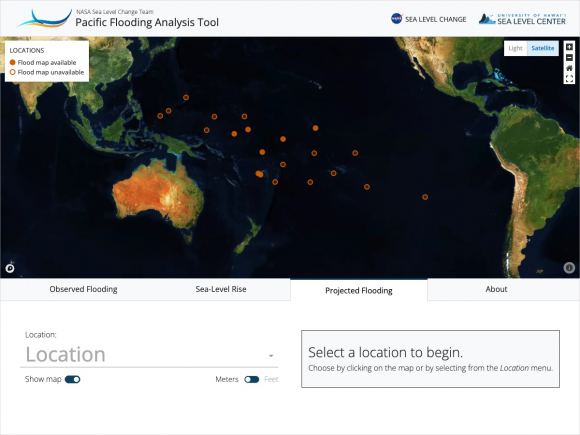
- NASA’s Pacific Islands Flooding Tool is a key resource for understanding sea level projections.
- Different emissions scenarios (best-case to worst-case) are considered in predictive models.
- The islands could experience at least 15 cm of sea level rise by 2050.
- High-tide flood days could increase from 5 to 25 annually for some islands, causing extreme disruptions.
- Local conditions, such as coastlines and topography, influence how sea level rise impacts each region.
- Ground-based measurements are scarce, limiting the full picture of sea level change.
- Real-world experiences, such as king tides and saltwater intrusion, are already devastating the islands.
- Scientific data is being used for early warning systems to protect communities.
- Adaptation strategies include flood mitigation and resilience planning.
- Satellite data is essential for global understanding and climate action efforts.
- The future of Pacific Island nations depends heavily on global response to climate change.
- Nations like Tuvalu are advocating for climate justice and international support.
- Tools such as NASA’s Pacific Islands Flooding Tool play a crucial role in understanding future scenarios.
Main Article:
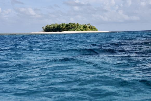
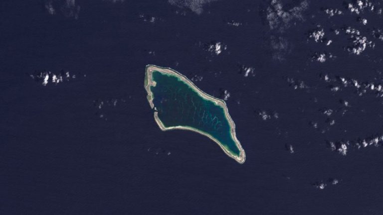
Small Pacific Island nations are among the first to face the consequences of rising sea levels due to climate change. Islands like Tuvalu, Kiribati, and Fiji stand at the frontlines of this global crisis, as they face the potential of being submerged by the ocean within the next 50 years. The cause? Sea level rise driven by climate change, and exacerbated by melting glaciers, the thermal expansion of seawater, and an increase in greenhouse gases. These changes pose an existential threat to millions of inhabitants whose very homes, cultures, and livelihoods are at stake.
NASA’s Role in Monitoring Sea Level Rise
NASA, in collaboration with leading research institutions, has been at the forefront of monitoring sea level changes. By using satellite data and sophisticated models, the agency is able to predict rising sea levels in various regions, particularly in the vulnerable Pacific Islands.
The Pacific Islands Flooding Tool, developed by NASA, is a groundbreaking resource. This tool allows scientists to assess the potential impacts of sea level rise on low-lying Pacific Islands. It provides high-resolution maps and predictive data to help these nations prepare for future flooding scenarios.
“Sea level will continue to rise for centuries, causing more frequent flooding,” says Dr. Nadya Vinogradova Shiffer, ocean physics expert at NASA. “NASA’s new flood tool tells you what the potential increase in flooding frequency and severity looks like in the next decades for coastal communities of the Pacific Island nations.”

How Sea Levels Are Measured
Sea level monitoring relies on a combination of ground-based and satellite-based technologies. NASA, along with universities such as the University of Hawaii and Virginia Tech, uses a variety of tools to measure sea levels, including:
- Satellites: Orbiting satellites such as TOPEX/Poseidon and Jason-3 provide critical data on sea levels across the globe.
- Ship-based measurements: Instruments on board research vessels collect sea-level data while traversing the ocean.
- Supercomputer analysis: Advanced models process the vast amounts of data collected to predict future sea levels.
These measurements, along with data from tide gauges on the ground, help scientists create models that can predict how sea levels will rise in the coming decades.

Table 1: Key Satellite Systems Monitoring Sea Levels
| Satellite Name | Primary Function | Launch Date | Data Collected |
|---|---|---|---|
| TOPEX/Poseidon | Sea level monitoring | 1992 | Global sea levels |
| Jason-1 | Continuation of TOPEX/Poseidon mission | 2001 | Sea level, ocean circulation |
| Jason-3 | High-precision ocean altimetry | 2016 | Global sea surface height |
| SWOT | Surface Water and Ocean Topography | 2022 | Freshwater bodies, ocean levels |
Impact on Pacific Island Nations
How severe is the threat? The NASA-led study reveals that the Pacific Islands could see a sea level rise of at least 15 centimeters by 2050. This may not seem like much, but for island nations where the highest elevation is just a few meters above sea level, it’s a disaster in waiting.
- Tuvalu currently experiences fewer than five high-tide flood days each year. By 2050, that number could rise to 25.
- Kiribati may face as many as 65 high-tide flood days annually within the same time frame.
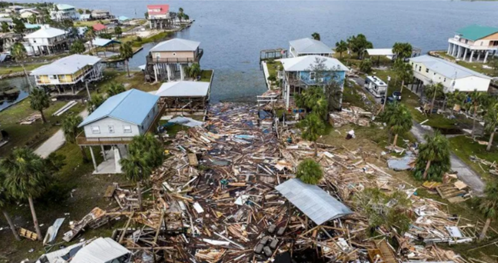
This will have devastating effects on infrastructure, agriculture, and daily life. Coastal erosion, flooding, and saltwater intrusion into freshwater supplies are just some of the immediate threats.
“I am living the reality of climate change,” says Grace Malie, a youth leader from Tuvalu involved in the Rising Nations Initiative. “Everyone lives by the coast, so everyone gets heavily affected by this.”
Table 2: Projected Sea Level Rise for Pacific Islands by 2050
| Island Nation | Current Annual Flood Days | Projected Annual Flood Days (2050) |
|---|---|---|
| Tuvalu | 5 | 25 |
| Kiribati | 10 | 65 |
| Fiji | 8 | 30 |
| Marshall Islands | 7 | 45 |
Real-World Consequences of Rising Sea Levels
For Pacific Island nations, the future is becoming increasingly uncertain. The impacts of sea level rise go beyond simple flooding:
- King Tides: These exceptionally high tides are already causing flooding in many Pacific Islands. As sea levels rise, these tides will become more frequent and destructive.
- Saltwater Intrusion: Rising seas cause saltwater to penetrate underground water sources, contaminating freshwater supplies. This impacts agriculture, drinking water, and the natural ecosystem.
- Erosion: Coastal erosion is another significant threat. As shorelines recede, infrastructure and homes are lost to the ocean.
Grace Malie adds, “There are points on the island where we will see seawater bubbling from beneath the surface and heavily flooding the area.”

Adapting to the Future
Despite the grim predictions, Pacific Island nations are taking steps to mitigate the impact of rising sea levels. With the help of satellite data, they are implementing flood mitigation strategies and investing in resilience-building projects. NASA’s data is critical in shaping these strategies.
Some nations are even exploring the possibility of relocating entire communities to higher ground or neighboring countries. This is a drastic step but may be the only option if sea levels continue to rise.
“The future of the young people of Tuvalu is already at stake,” Malie explains. “Climate change is more than an environmental crisis. It is about justice, survival for nations like Tuvalu, and global responsibility.”
The fight against rising sea levels is not just a local issue for Pacific Island nations; it is a global challenge. The continued rise of greenhouse gas emissions will exacerbate the problem. Satellite data is vital for understanding these changes and helping vulnerable nations adapt. However, real solutions require a global effort to reduce emissions, slow the melting of glaciers, and address climate change on a broad scale.
As Pacific Island nations struggle to survive, the world must come together to ensure they have the tools and support they need. The rising seas are a clear sign that time is running out.
References
- NASA Analysis on Sea Level Rise
- Pacific Islands Flooding Tool
- Rising Nations Initiative
- TOPEX/Poseidon Mission

