Tag

#RemoteSensing

Browsing

NASA Launches Cutting-Edge Satellite for Polar Climate Study

Key Takeaway

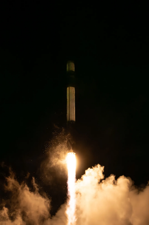
NASA launched the first of two shoebox-sized satellites called PREFIRE (Polar Radiant Energy in the Far-InfraRed Experiment) to study Earth’s heat emissions at the poles. This data will improve our understanding of how Earth’s climate is changing.

Summary

  • Mission Goal: The PREFIRE mission aims to measure the amount of heat Earth radiates from the poles, which are critical regions for regulating Earth’s climate.
  • Launch: The first PREFIRE CubeSat was launched on May 25, 2024, aboard an Electron rocket from Rocket Lab. A second launch is planned soon.
  • Mission Duration: The mission is expected to operate for 10 months after a 30-day checkout period.
  • Scientific Importance: The far-infrared radiation emitted from Earth’s poles is not currently well-measured. PREFIRE will provide crucial data to improve our understanding of Earth’s energy balance and how it is affected by factors like ice melt and cloud cover.
  • Benefits: Improved climate and weather models will aid researchers in predicting the impacts of climate change on Earth’s ice, seas, and weather patterns. This information will be valuable for sectors like agriculture, fishing, and coastal communities.
  • Partners: This collaborative mission was developed by NASA and the University of Wisconsin-Madison.
  • Tech Behind the Mission: The tiny satellites, called CubeSats, carry miniaturized thermal infrared spectrometers to measure infrared wavelengths.

NASA Launches Cutting-Edge Satellite for Polar Climate Study

Our planet’s climate is a complicated dance between incoming solar radiation and the heat Earth radiates back out into space. Understanding this energy balance is crucial for predicting the impacts of climate change. But there’s a critical gap in our knowledge: far-infrared radiation emitted from Earth’s poles, which play a giant role in regulating global temperatures, remains poorly measured.

This is where NASA’s recently launched PREFIRE (Polar Radiant Energy in the Far-InfraRed Experiment) mission comes in.

Shedding Light on the Polar Chill

PREFIRE is a game-changer. Forget clunky, massive satellites – the mission utilizes two minisatellites, affectionately called CubeSats, each about the size of a shoebox. These tiny titans pack a powerful punch, carrying miniaturized thermal infrared spectrometers to measure the far-infrared wavelengths escaping from Earth’s poles.

The first PREFIRE CubeSat hitched a ride on a Rocket Lab’s Electron rocket on May 25, 2024, with its twin set to follow soon. Following a checkout period, the mission is expected to be operational for 10 months, gathering crucial data on Earth’s energy balance at the Arctic and Antarctic.

Big Benefits from Small Packages

The significance of PREFIRE cannot be overstated. By filling this critical data gap, the mission will provide scientists with a more comprehensive picture of Earth’s energy budget. This improved understanding will significantly enhance climate and weather models, allowing for more accurate predictions of how a warming world will affect Earth’s polar ice caps, sea levels, and weather patterns.

These insights have far-reaching implications. Better climate models will equip sectors like agriculture, fishing, and coastal communities with the knowledge they need to prepare for and adapt to the inevitable consequences of climate change.

A Collaborative Effort with Monumental Potential

The PREFIRE mission is a testament to the power of collaboration. This innovative project is a joint effort between NASA and the University of Wisconsin-Madison. While NASA’s Jet Propulsion Laboratory manages the mission and provided the spectrometers, Blue Canyon Technologies built the CubeSats, and the University of Wisconsin-Madison will take the lead in processing the treasure trove of data collected during the mission.

The miniaturization of the technology behind PREFIRE represents another major leap forward in space exploration. These CubeSats demonstrate the immense potential of smaller, more cost-effective satellites to revolutionize our understanding of Earth and beyond.

The launch of the first PREFIRE CubeSat marks a new chapter in Earth science. With these tiny titans gazing down at our planet’s poles, we can anticipate giant strides in unraveling the mysteries of Earth’s climate and charting a course for a sustainable future.

For more details, read the source: NASA’s PREFIRE Mission.

HASHTAGS:

#NASA, #ClimateChange, #EarthScience, #PREFIRE, #CubeSats, #RemoteSensing, #Poles, #FarInfrared, #EnergyBalance, #ClimatePrediction #arctic ice climate change

Antarctic 2024: Another Giant Antarctic Iceberg Breaks Free

Key Takeaway

The recent calving of a giant iceberg (A-83) from the Brunt Ice Shelf in Antarctica is another sign of the weakening ice shelves due to rising global temperatures.

Summary

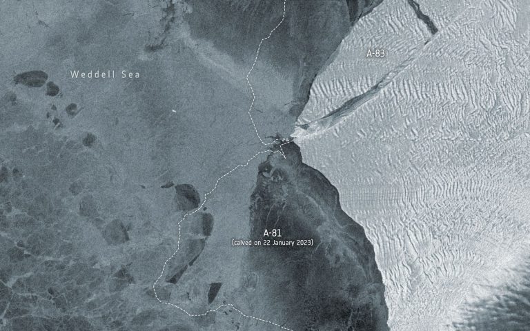
  • A large iceberg measuring 380 square kilometers (147 square miles) named A-83 broke away from the Brunt Ice Shelf in Antarctica on May 20th, 2024.
  • This is the third major calving event in Antarctica in the last four years, following A-74 in 2021 and A-81 in 2023.
  • Satellites like ESA’s Copernicus Sentinel-1 and NASA’s Landsat 8 captured the calving event using radar imaging and thermal data.
  • The calving is attributed to the weakening of ice caused by the McDonald Ice Rumples and the extension of the ‘Halloween Crack’ in the Brunt Ice Shelf.
  • Scientists use satellite data to monitor ice shelf health in response to climate change.
  • The iceberg doesn’t pose a threat to the Halley VI Research Station, which was relocated earlier due to ice shelf instability.
  • The ongoing ice loss in Antarctica is a worrying sign of global warming, leading to sea-level rise, coastal flooding, and further temperature increase.
  • Monitoring polar ice plays a crucial role in climate change adaptation and reduction strategies.
Data on brightness temperature is from the U.S. Landsat 8 mission. Credit: ESA/USGS

Another Antarctic Iceberg Breaks Away

The icy expanse of Antarctica is constantly changing, but a recent event has scientists raising a collective eyebrow. On May 20th, 2024, a massive iceberg measuring a staggering 380 square kilometers (147 square miles) broke away from the Brunt Ice Shelf. This behemoth, named A-83, marks the third significant calving event in Antarctica in just four years, following A-74 in 2021 and the even larger A-81 in 2023.

These repeated calving events are a stark reminder of the accelerating impact of climate change on the Earth’s polar regions. The Brunt Ice Shelf is a critical buttress for glaciers flowing into the Weddell Sea. As the ice shelf weakens, these glaciers lose support and accelerate their flow into the ocean, contributing to rising sea levels.

The culprit behind the recent calving is a combination of factors. The McDonald Ice Rumples, underwater ridges that disrupt the flow of ice, have weakened the Brunt Ice Shelf for some time. Additionally, a vast crack, ominously nicknamed the “Halloween Crack,” has steadily grown within the ice shelf, further compromising its structural integrity.

Thankfully, sophisticated Earth observation satellites are keeping a watchful eye on Antarctica. ESA’s Copernicus Sentinel-1 and NASA’s Landsat 8 played a vital role in capturing the calving event. Sentinel-1, with its radar imaging capabilities, can see through clouds and darkness, providing valuable data year-round. Landsat 8, on the other hand, uses thermal imaging to help scientists assess ice sheet thickness. By analyzing these different datasets, scientists can monitor changes in ice shelves and understand the mechanisms driving calving events.

The good news is that the A-83 iceberg doesn’t pose an immediate threat to the British Antarctic Survey’s Halley VI Research Station. The station was strategically relocated in 2017 due to concerns about ice shelf stability. However, the bigger picture remains a cause for concern. The ongoing loss of ice from Antarctica is a significant contributor to rising sea levels. This, in turn, threatens coastal communities around the world with increased flooding and erosion.

Furthermore, as polar ice sheets melt, they expose darker ocean surfaces that absorb more solar radiation. This creates a vicious cycle, accelerating global warming even further.

The recent calving event in Antarctica underscores the urgency of addressing climate change. Continued monitoring of the polar ice caps through advanced satellite technology is crucial for understanding the pace and impact of ice loss. This data is essential for developing effective mitigation strategies and adaptation plans to tackle the challenges posed by a warming planet.

This isn’t just a story about a giant iceberg breaking free. It’s a story about the interconnectedness of our planet and the far-reaching consequences of climate change. By understanding the science behind these events, we can take informed action to ensure a sustainable future for ourselves and generations to come.

HASHTAGS:

#Antarctica, #Icebergs, #ClimateChange, #GlobalWarming, #Glaciology, #EarthScience, #SeaLevelRise, #RemoteSensing, #PolarIce, #Environment, #antarctic 2024

References

  1. IPCC Sixth Assessment Report – Intergovernmental Panel on Climate Change (IPCC)
  2. Iceberg A-83 Breaks Free – European Space Agency (ESA)

Russia Activates World’s First Satellite System for Arctic Monitoring

Key Takeaway

Russia has launched the world’s first dedicated Arctic observation satellite system, aimed at providing round-the-clock monitoring of the Arctic region, supporting navigation and shipping along the Northern Sea Route, as well as facilitating hydrocarbon exploration.

Summary

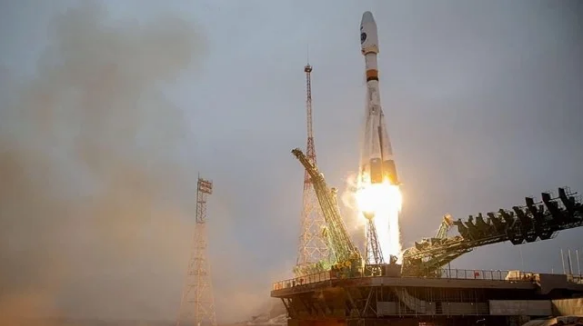
  • Over the weekend, Russia activated the world’s first Arctic observation satellite system, drawing data from the two Arktika-M satellites launched in 2021 and 2022.
  • The new satellite constellation provides continuous meteorological and environmental monitoring of the Arctic surface and the Northern Sea Route.
  • Russia has created a hydro-meteorological space system that allows permanent observation of the Arctic regions and its adjacent territories, a first in the world.
  • The complete Arktika mission constellation is planned to eventually have 10 Earth-orbiting satellites, including communication, GPS, commercial, and remote sensing satellites.
  • The satellites will be placed in a Highly Elliptical Orbit (HEO), ensuring full-time coverage of the high latitudes, which is not provided by existing international geostationary satellites.
  • The Arktika system will also be used for hydrocarbon exploration, aligning with Russia’s ambition to intensify exploitation of the Arctic’s oil and gas resources.
  • Importantly, the space system will provide telecommunications services in the Arctic, which Russia needs for air traffic and commercial shipping in the remote region.
  • Russia has heavily invested in the development of the Northern Sea Route, hoping it could become an alternative shipping route as sea ice in the Arctic recedes, shortening the distance between the Far East and the West compared to the Suez Canal route.

Russia Activates World's First Satellite System for Arctic Monitoring

Russia Activates World’s First Satellite System for Arctic Monitoring

In a bold move to assert its dominance in the Arctic region, Russia has launched the world’s first dedicated Arctic observation satellite system. This groundbreaking initiative aims to provide round-the-clock monitoring of the vast and rapidly changing Arctic landscape, supporting navigation and shipping along the strategic Northern Sea Route, as well as facilitating hydrocarbon exploration.

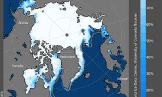
The Arctic has long been a region of intense interest and competition among nations, driven by its vast untapped natural resources and the potential for new shipping routes as sea ice melts due to climate change. Russia, with its extensive Arctic coastline, has consistently sought to strengthen its presence and control in this strategic area.

Over the weekend, Russia activated its Arctic observation satellite system, drawing data from the two Arktika-M satellites launched in 2021 and 2022. This new constellation provides continuous meteorological and environmental monitoring of the Arctic surface and the Northern Sea Route, a crucial shipping lane that Russia hopes will become a viable alternative to the Suez Canal route.

The complete Arktika mission constellation is planned to eventually have 10 Earth-orbiting satellites, including communication, GPS, commercial, and remote sensing satellites. These satellites will be placed in a Highly Elliptical Orbit (HEO), ensuring full-time coverage of the high latitudes, which is not provided by existing international geostationary satellites.

One of the key objectives of the Arktika system is to facilitate hydrocarbon exploration in the Arctic, aligning with Russia’s ambition to intensify the exploitation of the region’s oil and gas resources. Additionally, the space system will provide crucial telecommunications services in the Arctic, essential for air traffic and commercial shipping in this remote and challenging environment.

Russia has heavily invested in the development of the Northern Sea Route, a shipping lane that runs along the Siberian coastline. As sea ice in the Arctic continues to recede due to climate change, Russia hopes that this route could become a viable alternative to the Suez Canal, significantly shortening the distance between the Far East and the West.

While Russia’s Arctic ambitions are undoubtedly bold, they also raise concerns about the potential environmental impact of increased economic activity in the fragile Arctic ecosystem. Additionally, the militarization of the region and the potential for conflicts over territorial claims and resource extraction rights remain ongoing issues.

Despite these challenges, Russia’s commitment to advancing its Arctic capabilities is clear. The launch of the world’s first dedicated Arctic observation satellite system represents a significant technological and strategic milestone, positioning Russia as a leader in this rapidly evolving frontier.

HASHTAGS:

#Arctic, #Russia, #Satellites, #NorthernSeaRoute, #Exploration, #ClimateChange, #Shipping, #RemoteSensing, #Telecommunication, #SpaceTechnology

Source: teleSUR English Link: Read more

Pin It
error: Content is protected !!

On this website we use first or third-party tools that store small files (<i>cookie</i>) on your device. Cookies are normally used to allow the site to run properly (<i>technical cookies</i>), to generate navigation usage reports (<i>statistics cookies</i>) and to suitable advertise our services/products (<i>profiling cookies</i>). We can directly use technical cookies, but <u>you have the right to choose whether or not to enable statistical and profiling cookies</u>. <b>Enabling these cookies, you help us to offer you a better experience</b>.