Tag

#LunarSafety

Browsing

SOS from Space: How Astronauts Would Call for Help from the Moon

Exploring the Moon presents immense challenges, not just in terms of survival but also in ensuring timely rescue during emergencies. To address these challenges, Australian researchers have proposed a novel lunar distress system based on COSPAS-SARSAT technology. This groundbreaking approach uses low-power emergency beacons and a satellite network to ensure communication, location tracking, and coordination for lunar rescue missions. The solution not only enhances astronaut safety but also holds the potential to improve emergency systems on Earth.

Summary

  • The Need for a Lunar Distress System: The Moon’s harsh environment demands robust emergency solutions for astronauts.
  • Technology Inspiration: Researchers adapted the Earth-based COSPAS-SARSAT system for lunar use.
  • Low-Power Emergency Beacons: These beacons are lightweight and require minimal setup.
  • Satellite Constellation: A network of small satellites will enable communication and navigation for rescue operations.
  • Integration with Artemis Program: The system aligns with NASA’s Artemis objectives of sustained human presence on the Moon.
  • Collaborative Efforts: Scientists from Australia and the United States are spearheading the project.
  • Impact Beyond the Moon: This innovation could also transform emergency responses in remote Earth locations.
  • Battery Longevity: Emergency beacons will last significantly longer than conventional solutions.
  • Firsts for Artemis: The Artemis missions will include diverse astronauts, emphasizing inclusivity in space exploration.
  • Lunar Environment Challenges: Craters, mountainous regions, and extreme temperatures create unique rescue challenges.
SOS from Space How Astronauts Would Call for Help from the Moon
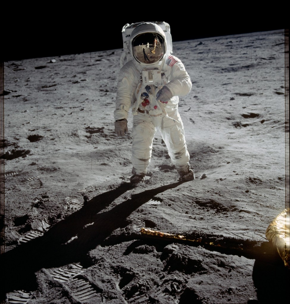
Aldrin on the Moon. Astronaut Buzz Aldrin walks on the moon’s surface. He is near the lunar module Eagle’s leg. This happened during the Apollo 11 mission. Neil Armstrong, the mission commander, took this photograph. He used a 70mm lunar surface camera. Armstrong and Aldrin explored the Sea of Tranquility. This is a region on the moon. Meanwhile, astronaut Michael Collins stayed in lunar orbit. He was with the command and service modules. The image is credited to NASA.

Main Article

The Moon’s environment is nothing short of extreme. Unlike Earth, it lacks an atmosphere, leaving astronauts exposed to harmful radiation, micrometeorites, and temperature extremes. Even minor accidents in this hostile environment could prove fatal without a reliable rescue system.

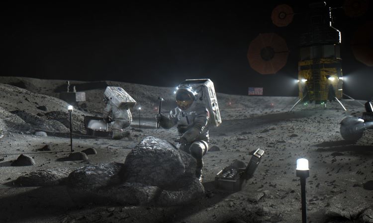
Researchers identified this gap as they prepared for NASA’s Artemis program, which plans to establish a sustained human presence on the Moon by the mid-2020s. One significant challenge was ensuring astronauts could call for help in emergencies when traditional Earth-based communication systems may fail.

π‘‡π‘’π‘β„Žπ‘›π‘œπ‘™π‘œπ‘”π‘¦ πΌπ‘›π‘ π‘π‘–π‘Ÿπ‘Žπ‘‘π‘–π‘œπ‘›: 𝐢𝑂𝑆𝑃𝐴𝑆-𝑆𝐴𝑅𝑆𝐴𝑇

The COSPAS-SARSAT system, used globally for search and rescue operations, served as inspiration. This Earth-based system has been saving lives for decades using satellites to track distress signals from beacons on land, sea, and air. By adapting this technology for lunar missions, researchers could overcome the Moon’s communication challenges.

π‘‡β„Žπ‘’ πΈπ‘šπ‘’π‘Ÿπ‘”π‘’π‘›π‘π‘¦ π΅π‘’π‘Žπ‘π‘œπ‘›π‘ : π‘†π‘šπ‘Žπ‘Ÿπ‘‘ π‘Žπ‘›π‘‘ 𝐸𝑓𝑓𝑖𝑐𝑖𝑒𝑛𝑑

Emergency beacons developed for this project are lightweight and durable, designed for easy activation by astronauts. They operate on low power, ensuring longer battery lifeβ€”a critical requirement in remote lunar locations where rescues could take days.

Table 1: Features of Lunar Emergency Beacons
Feature Description Impact
Low Power Operates on minimal energy Prolonged usability
Lightweight Design Easy for astronauts to carry Reduces mission payload
Durable Build Resistant to lunar conditions Ensures reliability

The project envisions a constellation of small satellites orbiting the Moon. These satellites will relay emergency signals from astronauts to Earth or nearby lunar stations. This approach ensures that even astronauts in deep craters or behind mountainous terrain can communicate effectively.

Table 2: Lunar Satellite Network vs. Traditional Communication
Aspect Lunar Satellite Network Traditional Communication
Coverage Comprehensive lunar surface Limited
Real-Time Tracking Yes No
Resilience in Terrain High Low

The technology developed for the Moon can revolutionize search and rescue operations on Earth. In regions where mobile signals are unreliable, these beacons could provide a lifeline during disasters such as earthquakes or floods.
SOS from Space How Astronauts Would Call for Help from the Moon
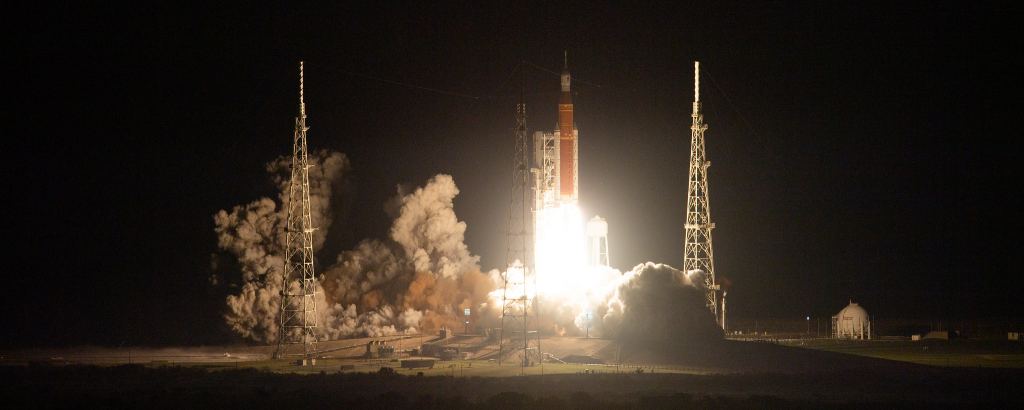
The Space Launch System rocket is a powerful rocket developed by NASA. It carried the Orion spacecraft on the Artemis I flight test. This launch happened on Wednesday, November 16, 2022. The launch took place at Launch Complex 39B. This location is at NASA’s Kennedy Space Center in Florida. The credit for the image goes to NASA/Joel Kowsky.

NASA’s Artemis program has ambitious goals: returning humans to the Moon, establishing a base camp, and preparing for Mars exploration. The lunar distress system seamlessly aligns with these objectives, ensuring astronaut safety as they navigate uncharted territories.

Artemis I successfully tested the Orion spacecraft in 2022, setting the stage for future crewed missions. Artemis II will follow in 2025, with astronauts venturing to the Moon’s surface. This rescue technology will play a pivotal role in ensuring their safety.

The University of South Australia and American partners have been at the forefront of this initiative. The Australian government allocated $100,000 to support the development of the Lunar Search and Rescue (LSAR) system. This collaboration is expected to elevate Australia’s role in global space exploration efforts.

πΆβ„Žπ‘Žπ‘™π‘™π‘’π‘›π‘”π‘’π‘  π΄β„Žπ‘’π‘Žπ‘‘

Despite its promise, the lunar distress system faces challenges, including:

  • High Costs: Developing and deploying satellites is expensive.
  • Harsh Lunar Conditions: The Moon’s extreme temperatures and radiation levels could affect system durability.
  • Long-Distance Communication: Ensuring low-latency signal transmission over 384,400 km.

The lunar distress system represents a significant leap in ensuring astronaut safety on the Moon. By adapting proven Earth-based technology, researchers have created a solution that addresses the unique challenges of lunar exploration. This innovation not only advances the Artemis program but also offers practical applications on Earth, reinforcing the interconnectedness of space and terrestrial advancements.

References

  1. University of South Australia: Lunar Distress System
  2. NASA Artemis Program
  3. COSPAS-SARSAT Official Site
  4. Safety from Space Initiatives
#SpaceExploration, #LunarSafety, #ArtemisProgram, #COSPAS_SARSAT, #EmergencyResponse, #LunarResearch, #SearchAndRescue, #MoonMissionTech, #InnovationInSpace, #AstronautSafety

About The Moon Today: Breakthroughs in Creating Detailed Lunar Maps

Key Takeaways

Researchers at Brown University have enhanced the technique of creating lunar maps using satellite images. The advanced method, known as ‘shape-from-shading’, analyzes shadows to estimate terrain features and shapes. Detailed lunar maps are critical for safe and efficient future lunar missions. The Artemis project, aiming for the Moon’s south pole, will benefit greatly from these high-resolution maps. New algorithms automate image alignment and quality control, significantly improving map accuracy.

Summary

  • Enhanced Technique: Brown University researchers improved the ‘shape-from-shading’ method for creating lunar maps.
  • Importance of Maps: High-resolution maps are crucial for lunar missions to identify safe landing sites and areas of interest.
  • Automation and Accuracy: Advanced algorithms automate the process, align images accurately, and filter poor-quality images.
  • Validation: The new technique produces more precise maps compared to traditional methods.
  • Future Missions: Projects like Artemis will benefit from these detailed maps, especially in poorly mapped areas like the Moon’s south pole.

Breakthroughs in Creating Detailed Lunar Maps

There was a time when maps of the Moon were created from telescopic observations and drawings. Indeed, Sir Patrick Moore created maps of the Moon that were used during the historic Apollo landings. Today, researchers have developed a sophisticated technique to create accurate maps from existing satellite images. This approach, known as ‘shape-from-shading’, involves analyzing shadows to estimate the features and shape of the terrain. Future lunar missions will be able to use these maps to identify hazards on the surface, making them far safer.

Advancements at Brown University

Researchers at Brown University in Rhode Island have refined the process used to map the surface of the Moon, making it more accurate than ever before. Their paper, published in the Planetary Science Journal and authored by Benjamin Boatwright and his team, details the enhancements to the mapping technique. This technique can generate detailed models of the Moon’s surface to highlight craters, ridges, and slopes from composites of 2D images.

Highly detailed maps are of crucial importance to lunar missions as they help planners identify the safest places to land. They can also pinpoint areas of particular interest that require further study, enabling the entire mission to be far more efficient. Missions such as the Artemis project will benefit significantly when it heads for the south pole of the Moon, an area that is not well mapped. High-resolution maps of this region will aid autonomous landing systems in avoiding hazards.

Challenges and Solutions

Creating these maps is a time-consuming job and is particularly challenging when lighting levels in the target area are poor. Previously, the interpretation of shadows was less effective, but the team at Brown University addressed these issues. In their paper, they explain how advanced computer algorithms can automate much of the process and improve the resolution of the generated models. Their new software provides lunar astronomers with the necessary tools and information to create larger, more detailed maps of the surface.

To allow lunar scientists to create a map from images, at least two images of the same area are required. Each image must be perfectly aligned with its counterpart so that features in one are in the exact same place in the other. Until now, the technology has not been able to take multiple images of an area and create a perfect map. Boatwright stated, “We implemented an image alignment algorithm where it picks out features in one image and tries to find those same features in the other and then line them up, so that you’re not having to sit there manually tracing interest points across multiple images, which takes a lot of hours and brainpower.”

Along with the image alignment algorithm, the researchers created quality control algorithms and filters to remove poor-quality images from the alignment process. By only inputting high-quality images into the process, the output is of far higher quality. This approach is similar to astronomical imaging, which processes multiple images through stacking and alignment techniques.

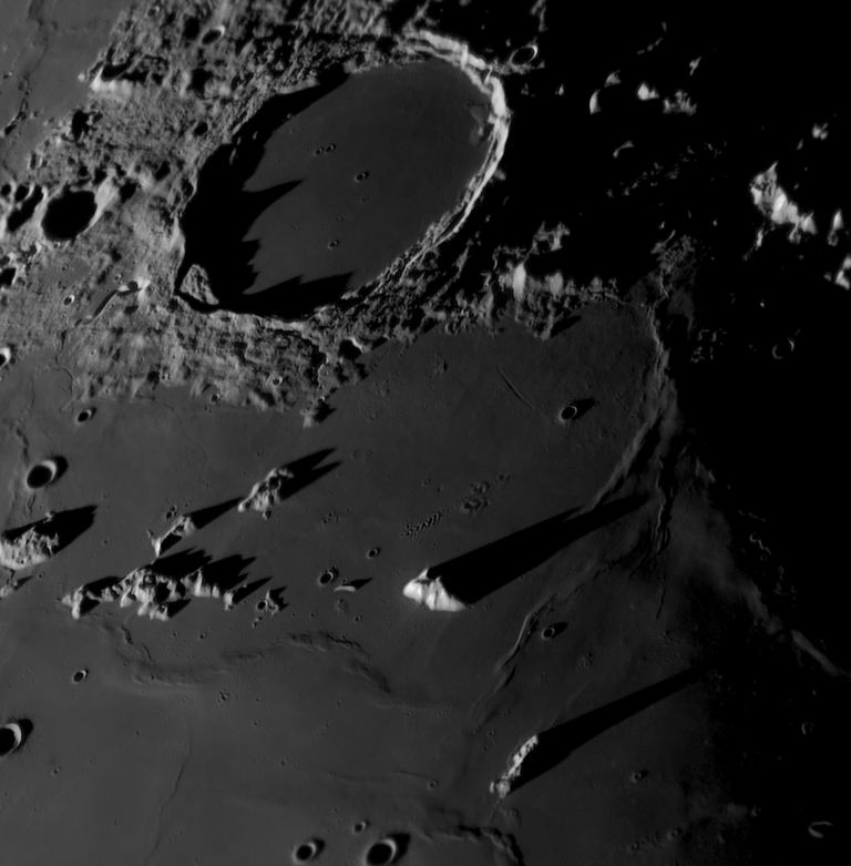
Lunar surface in close detail (Image credit NASA)

Table 1: Key Improvements in Lunar Mapping Techniques

Improvement Description
Shape-from-shading Analyzes shadows to estimate terrain features and shapes
Image alignment Uses algorithms to perfectly align multiple images of the same area
Quality control Filters out poor-quality images to enhance the final output
Automation Advanced software automates much of the mapping process

Validation and Future Applications

To evaluate the accuracy of their work, the team compared the output from existing maps of the Moon to look for errors. To their delight, they found that maps created using their enhanced ‘shape-from-shading’ technique were more precise compared to those produced using traditional techniques.

Table 2: Comparison of Traditional vs. Enhanced Mapping Techniques

Feature Traditional Technique Enhanced ‘Shape-from-shading’ Technique
Image quality Varied, manual selection Automated selection of high-quality images
Image alignment Manual tracing of features Automated algorithm-based alignment
Shadow interpretation Less effective Highly effective
Map accuracy Lower precision Higher precision

Importance of Detailed Lunar Maps

The creation of highly detailed lunar maps is not just a technological achievement but a necessity for the future of lunar exploration. These maps play a crucial role in ensuring the safety and efficiency of lunar missions. They help mission planners identify safe landing sites, avoiding hazards such as large boulders or deep craters. Additionally, they enable scientists to locate areas of scientific interest, such as regions with unusual geological formations or potential resources like water ice.

Impact on Future Lunar Missions

The Artemis project, which aims to return humans to the Moon and establish a sustainable presence, will greatly benefit from these detailed maps. The south pole of the Moon, a region of particular interest due to its potential water ice deposits, is not well mapped. High-resolution maps of this area will be invaluable for the mission’s autonomous landing systems, helping them to avoid hazards and select the safest landing sites.

Moreover, detailed maps will aid in the planning of future lunar bases. Understanding the terrain is crucial for selecting locations for habitats, scientific instruments, and other infrastructure. By providing accurate and detailed maps, researchers can ensure that these bases are built in optimal locations, maximizing safety and efficiency.

Conclusion

The breakthroughs in creating detailed lunar maps represent a significant advancement in lunar exploration. The enhanced ‘shape-from-shading’ technique developed by researchers at Brown University, along with advanced algorithms for image alignment and quality control, have resulted in maps with unprecedented detail and accuracy. These maps are crucial for the success of future lunar missions, ensuring safe landings and efficient exploration of the Moon’s surface.

References

  1. Researchers at Brown University have developed a new technique. This technique offers more precise maps of the Moon’s surface.
  2. Boatwright, B., et al. (2024). Enhanced Lunar Mapping Techniques. Science Times.
  3. NASA. (2024). Artemis Mission Overview.
  4. Brown University. (2024). Advancements in Lunar Mapping Research.
  5. Moore, P. (1969). Lunar Mapping for Apollo Missions.

Hashtags

#LunarMapping, #ShapeFromShading, #MoonExploration, #ArtemisMission, #BrownUniversity, #NASA, #LunarResearch, #SpaceExploration, #FutureMissions, #LunarSafety

Pin It
error: Content is protected !!

On this website we use first or third-party tools that store small files (<i>cookie</i>) on your device. Cookies are normally used to allow the site to run properly (<i>technical cookies</i>), to generate navigation usage reports (<i>statistics cookies</i>) and to suitable advertise our services/products (<i>profiling cookies</i>). We can directly use technical cookies, but <u>you have the right to choose whether or not to enable statistical and profiling cookies</u>. <b>Enabling these cookies, you help us to offer you a better experience</b>.