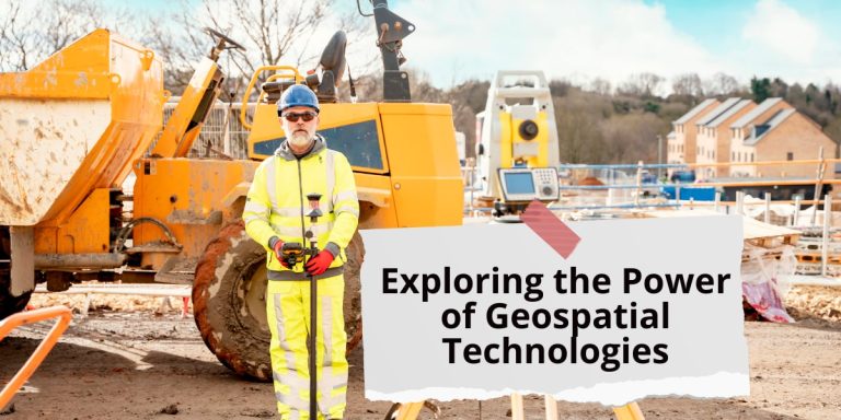
Exploring the Power of Geospatial Technologies
In today’s rapidly evolving technological landscape, geospatial technologies play a pivotal role in various fields, revolutionizing how we perceive, analyze, and interact with spatial data. From Geographic Information Systems (GIS) to Global Positioning System (GPS) and Remote Sensing, these tools offer unparalleled capabilities for mapping, monitoring, and decision-making.
Geographic Information Systems (GIS)
GIS is a computer-based mapping system that enables users to visualize data in a spatial context, facilitating better understanding and analysis. It allows for overlaying multiple layers of information on a map, enabling spatial analysis and gaining meaningful insights. From urban planning to environmental management and emergency response, GIS finds diverse applications, shaping our understanding of spatial relationships and phenomena.
Global Positioning System (GPS)
GPS technology utilizes satellites to precisely determine the locations of objects on Earth’s surface. It provides accurate location data crucial for mapping, navigation, and tracking. In consumer applications, GPS enables individuals to pinpoint their exact locations and receive turn-by-turn directions, enhancing navigation efficiency and convenience.
Remote Sensing
Remote sensing involves gathering information about Earth’s surface using sensors on planes or satellites. This technology captures images, elevation data, and other geospatial information essential for mapping and monitoring environmental changes. By leveraging remote sensing data, researchers and decision-makers gain valuable insights into various phenomena, from land cover changes to natural disasters.
LiDAR (Light Detection and Ranging)
LiDAR technology employs lasers to measure distances and create precise 3D representations of Earth’s surface. It is instrumental in generating digital elevation models and terrain maps, providing detailed insights into topographic features and landscape characteristics.
“GIS technology is not just a tool. It’s a science, and in some cases, it’s an art.” – Esri
Geospatial data privacy is a critical consideration in the utilization of these technologies, particularly concerning individual identifiers present in datasets. It’s essential to safeguard privacy while harnessing the power of spatial data for various applications.
Geospatial Artificial Intelligence (geoAI)
Geospatial artificial intelligence (geoAI) merges spatial science with advancements in artificial intelligence, such as machine learning and data mining. This synergy enables the extraction of meaningful insights from spatial big data, offering computational efficiency and scalability across different geographic areas.
In environmental epidemiology, geoAI presents significant advantages for exposure modeling, incorporating large spatial and temporal data to assess the distribution of exposures in study populations. It enhances accuracy and efficiency in modeling spatial processes, paving the way for more informed decision-making in public health.
- Spatial science focuses on understanding real-world phenomena according to their locations, with spatial big data presenting significant opportunities and challenges.
- geoAI Methods and Applications: Interdisciplinary research showcases applications of geoAI in feature recognition, image enhancement, and predictive modeling for environmental monitoring.
- Opportunities in Environmental Epidemiology: GeoAI offers advantages for exposure modeling in environmental epidemiology, improving accuracy and efficiency.
- Future Directions: Future applications of geoAI may include historical exposure modeling and addressing spatial nonstationarity, emphasizing interdisciplinary collaboration and data quality.
- GeoAI holds promise for providing a more accurate understanding of environmental exposures, but careful consideration and collaboration are necessary for its successful application.
Navigating Through Spatial Science
Spatial science, synonymous with geographic information science, delves into dissecting real-world phenomena through a spatial lens. It encompasses the analysis, understanding, and visualization of phenomena based on their geographical coordinates.
Embracing the Era of Spatial Big Data
The advent of spatial big data heralds both opportunities and challenges. Generated in real-time from diverse sources like social media and environmental sensors, it presents a goldmine of information awaiting exploration and analysis.
The Fusion of Spatial Science and Artificial Intelligence
Geospatial artificial intelligence (geoAI) amalgamates spatial science with cutting-edge artificial intelligence techniques, particularly machine learning and data mining. This fusion enables the extraction of invaluable insights from spatial big data, propelling advancements across myriad domains.
Applications of geoAI: Transforming Environmental Epidemiology
Leveraging Interdisciplinary Expertise
GeoAI emerges at the intersection of computer science, engineering, statistics, and spatial science. Its interdisciplinary nature underscores its versatility and potential across various applications.
Unraveling the Potential of Deep Learning Algorithms
Recent strides in geoAI showcase its prowess in feature recognition, image enhancement, and semantic similarity identification. Deep learning algorithms spearhead these endeavors, enabling predictive modeling for phenomena like air pollution with unparalleled accuracy.
Revolutionizing Exposure Modeling in Environmental Epidemiology
In environmental epidemiology, accurate exposure modeling is paramount for assessing exposure distributions within study populations. GeoAI’s capacity to integrate vast spatial datasets, coupled with its computational efficiency, offers a paradigm shift in exposure modeling methodologies.
Future Directions and Conclusion
Paving the Path for Future Innovations
Future applications of geoAI in environmental epidemiology hold immense promise. From historical exposure modeling to addressing spatial nonstationarity, the horizon brims with possibilities awaiting exploration and implementation.
Embracing Collaboration for Progress
Cross-disciplinary collaboration emerges as a linchpin for fostering best practices in environmental exposure modeling. Upholding data quality standards and leveraging domain-specific expertise are pivotal for steering geoAI towards impactful applications in environmental epidemiology.
SmallSats (Small Satellites)
The trend of launching small satellites with quick return rates to locations is gaining momentum. These satellites, with a mass less than 180 kilograms, offer a cost-effective platform for various scientific investigations and technology demonstrations.
CubeSats
CubeSats, a class of nanosatellites, utilize a standard size and form factor, providing flexibility and affordability in space missions. Originally developed for education and exploration purposes, CubeSats now serve as integral components of advanced mission concepts and constellation deployments.
“CubeSats represent a democratization of space exploration, enabling broader participation and innovation in satellite technology.”
Unmanned Drones (Unmanned Aircraft Systems)
Unmanned drones, or unmanned aircraft systems (UAS), have transformed various industries, from aerial photography and surveillance to agriculture and disaster response. These autonomous vehicles offer unparalleled capabilities for gathering spatial data and conducting tasks in remote or hazardous environments.
Conclusion
In conclusion, geospatial technologies continue to redefine our understanding of the world, offering powerful tools for mapping, monitoring, and decision-making. From GIS and GPS to remote sensing and geoAI, these advancements hold immense potential across diverse domains, shaping the future of spatial analysis and exploration.

